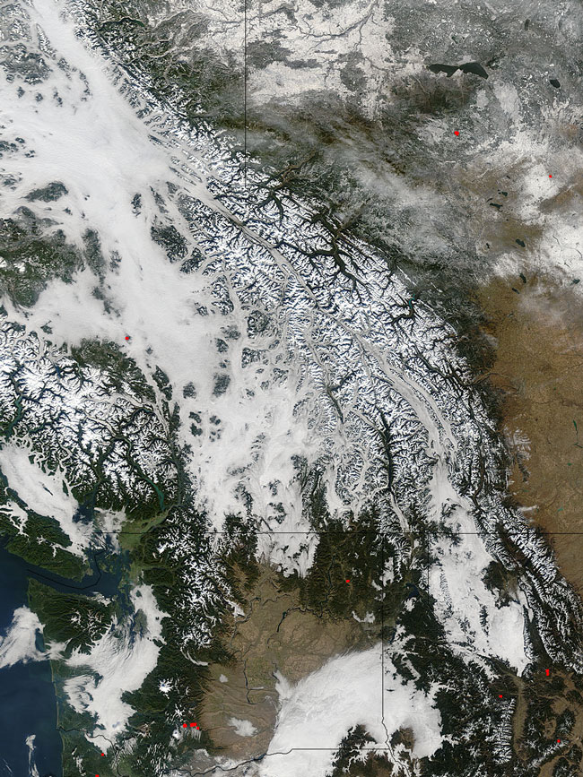
MODIS true color image (bands 1, 4, 3) of British Columbia, 11 November 2004.
With a little imagination, you could pretend that an ice age had begun overnight in the mountains of British Columbia, Canada, in mid-November 2004. The grayish-white layer of fog that reaches from the top left corner down toward image center could be taken for immense glaciers swallowing valleys and rising high up the slopes of crisply snow-covered mountains.
The mountains in this area run generally northwest to southeast. The easternmost range is the Rocky Mountains, which is lined on the west by a long, fog-filled valley (the Frasier River in the northern part, and the Columbia River in the southern part). On the far side of the valley lie the Columbia Mountains. Across a wide expanse of fog, the Coast Mountains occupy the center of the left edge of the image. Across the bottom of the scene, isolated patches of fog occur in (left to right) Washington, Idaho, and Montana. A few fires were detected by MODIS at the time of the image on November 11, and their locations are marked with red dots.
Text and image courtesy of NASA's MODIS Land Rapid Response Team.