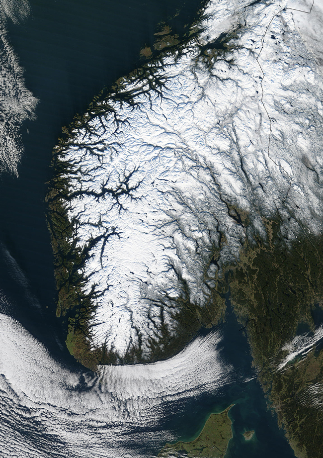
MODIS bands 1,4,3 RGB true color image of southern Norway and central Sweden on the 2nd of November 2002.
Snow blankets southern Norway and central Sweden in this true-color Terra MODIS image acquired November 2, 2002. Norway's capital, Oslo, is located at the northern end of the Oslofjorden, which opens into the Skagerrak Channel (lower right center). The Skagerrak separates Norway from Denmark, and connects to the Kattegat in the east (lower right). The Kattegat separates Denmark from southern Sweden. To the west of Denmark is the North Sea, while to the northwest of Norway is the Norwegian Sea.
Norway's two largest fjords, highlighted by snow, are the Sagnefjorden, the country's longest fjord at 204 km, and the Hardangerfjorden, which connects to the northeastern-pointing Sorfjorden. Norway claims 21,925 km of coastline, which includes the mainland, fjords, and tens of thousands of islands. With arctic tundra in the north, high plateaus, mountains, and fertile plains in the interior, and temperate coastlines in the south, Norway is home to a range of climates and landscapes.
Image and text courtesy of NASA's MODIS Land Rapid Response Team.