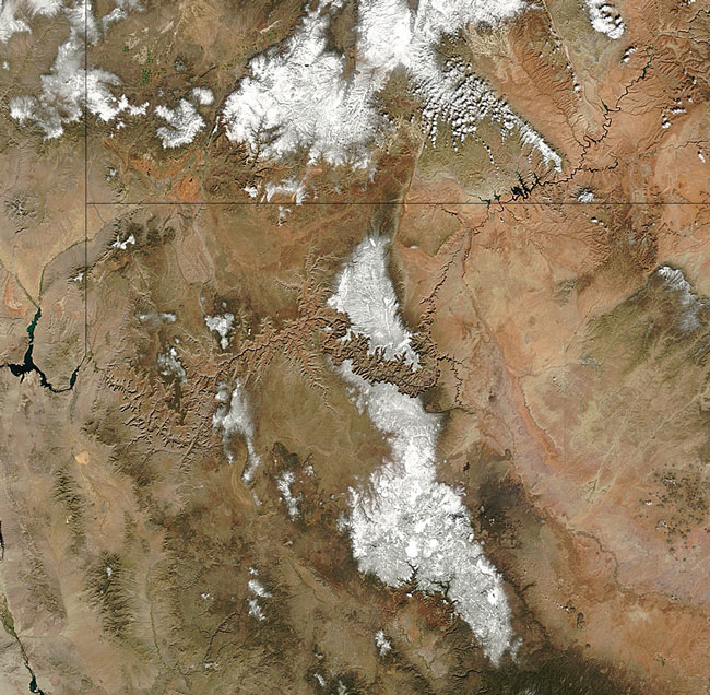
MODIS true color image (bands 1, 4, 3) of Arizona, 30 October 2004.
Snow dusts the higher elevations around the Grand Canyon in this true-color Terra MODIS image from October 30, 2004. The Grand Canyon likes in northern Arizona on the eastern edge of the Colorado Plateau. Running through the canyon in a thin black line is the Colorado River, which is fed by snow melt in the Rocky Mountains and flows gradually south and west to empty into the Gulf of California.
The Grand Canyon is one of the world's great wonders. At over a mile deep in places, from four to eighteen miles wide, and over 217 miles long, the canyon is a spectacular sight. It was forced through a combination of geological uplift, river erosion, submergence, and material deposits. The plant life also differs wildly from the top of the canyon to the bottom. At the top, plant life can be subarctic in nature, while they can be subtropical at the bottom.
Text and image courtesy of NASA's MODIS Land Rapid Response Team.