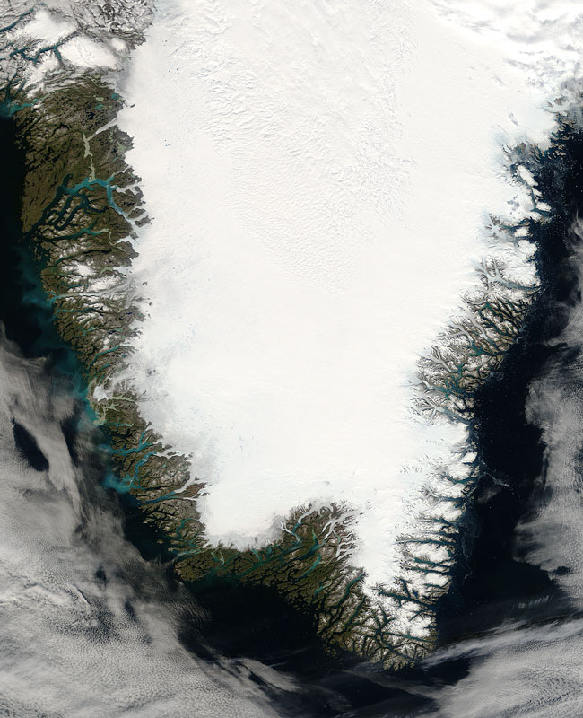
MODIS true color image (bands 1, 4, 3) of Greenland on the 23rd of August 2006.
This MODIS Terra image, acquired August 23, 2006, shows the southern portion of Greenland. As you can see from this image, about 81% of its surface is covered by ice - this is known as the Greenlandic ice cap. The weight of it has depressed the central land area to form a basin lying more than 300 m below sea level. Because of the ice coverage, nearly all Greenlanders live along the fjords in the south-west of the main island, which has a milder climate.
Text and image courtesy of NASA's MODIS Land Rapid Response Team.