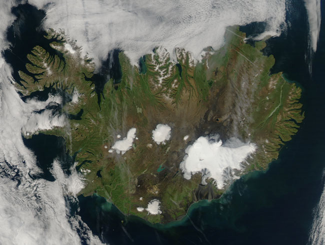
MODIS true color image (bands 1, 4, 3) of Iceland on the 16th of August 2006.
Iceland, shown in this MODIS Aqua image from August 16, 2006, is an island located in the North Atlantic Ocean just south of the Arctic Circle. Approximately 10 percent of the island is glaciated, and its coastline is punctuated by many fjords. Iceland has 3,088 miles (4,970 km) of coastline, which is where most towns are situated because the island's interior, the Highlands of Iceland, is a cold and uninhabitable combination of sands and mountains.
Several of Iceland's glaciers are visible in this image, including Vatnajokull, which is the the largest - it's the large white shape in the south-east of the island, covering more than 8% of the country. With a size of 8,100 square km, it is the largest glacier in Europe in volume and second largest in area.
Iceland is located on both a geological hot spot, thought to be caused by a mantle plume, and the Mid-Atlantic Ridge. This combined location means that the island is extremely geologically active, having many volcanoes, notably Hekla, Eldgja, and Eldfell. The island itself is composed primarily of basalt, or cooled lava. (Information provided by Wikipedia.)
Text and image courtesy of NASA's MODIS Land Rapid Response Team.