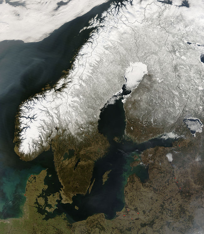
This image of the region often called Scandinavia, was captured by the MODIS on the Terra satellite on March 27, 2007. Snow covers much of the area, which is no suprise, considering the Arctic Circle runs through, just north of the Bay of Bothnia. The north end of the Bay of Bothnia, near the center of the image appears to be covered in ice.
The term Scandinavia is generally used to refer to the countries on the Scandinavian Peninsula, which are Norway and Sweden, and just south, Denmark. The countries of Finland (east of Sweden), Iceland and the Faroe Islands (both not pictured) are aften included because of their close connections - linguistic, cultural and historical.
Also pictured in this image are many of the northern European countries that border Scandinavia, which include, counterclockwise from the left: The Netherlands, Germany, Poland, Kaliningrad Oblast, Lithuania, Belarus, Latvia, Estonia, and Russia. Kaliningrad Oblast is actually a non-contiguous "exclave" of Russia. Black lines denote the country borders. The few red dots that you see are the locations of fires that MODIS has detected.
Text and image courtesy of NASA's MODIS Land Rapid Response Team.