The vernal equinox marks the start of spring in the Northern Hemisphere. But after a record setting warm winter, the start of spring 2006 came with an ironic twist: a powerful snowstorm that blanketed most of the American Midwest in heavy snow. According to the Associated Press, snow fell as rapidly as two inches an hour in Illinois and Indiana, while in parts of Nebraska, total accumulations were as much as two feet (roughly 60 centimeters) of snow, closing sections of Interstate 80. In Colorado and Kansas, the same snow system also forced closings along Interstate 70 on March 20. The AP was also reporting that at least five deaths had been attributed to the snow in Colorado, Nebraska, and Texas.
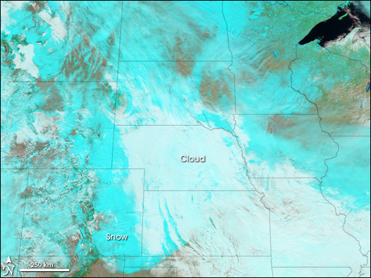
The Moderate Resolution Imaging Spectroradiometer (MODIS) on the Aqua satellite observed the wake behind the storm at 12:55 p.m. Mountain Time (19:45 UTC) on March 21, 2006. In this false-color image, cold high-altitude cloud appears white, snow and ice appear blue, and land colors vary from reddish tans to greens in areas of lesser or greater vegetation. While a thin layer of cloud covers much of the area where the heaviest snow fell the previous day, the long, wide swath of blue, occasionally visible through the thin cloud cover, shows the path of the snowstorm.
Text and image courtesy of NASA's Earth Observatory.