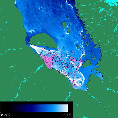
Ice Surface Temperature Map for James Bay, Canada
Above is a MODIS image taken February 24th 2000 of James Bay. 1 km resolution. Ice surface temperature map (white = warm, dark blue = cold) of the sea ice in James Bay. Clouds are shown in pink, land in green, and inland waterways in cyan.
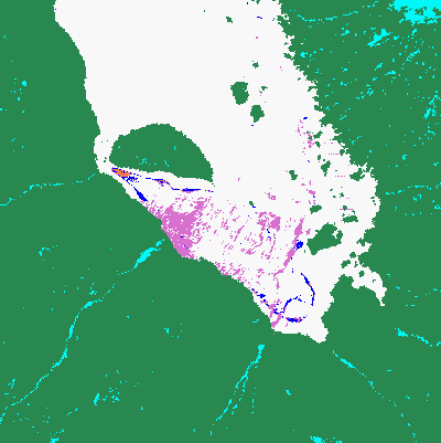
Sea Ice Map of James Bay, Canada
Sea Ice (white) map of James Bay (24 February 2000), mapped by reflectance characteristics of the ice. Clouds are shown in pink, land in green, and inland waterways in cyan. Orange pixels are where the Level 1B reflectance data is unusable.