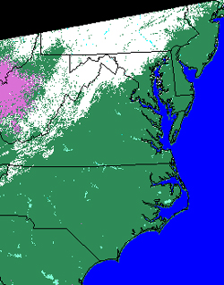
 MODIS corresponding snow map of the Eastern United States, 8 February 2004.
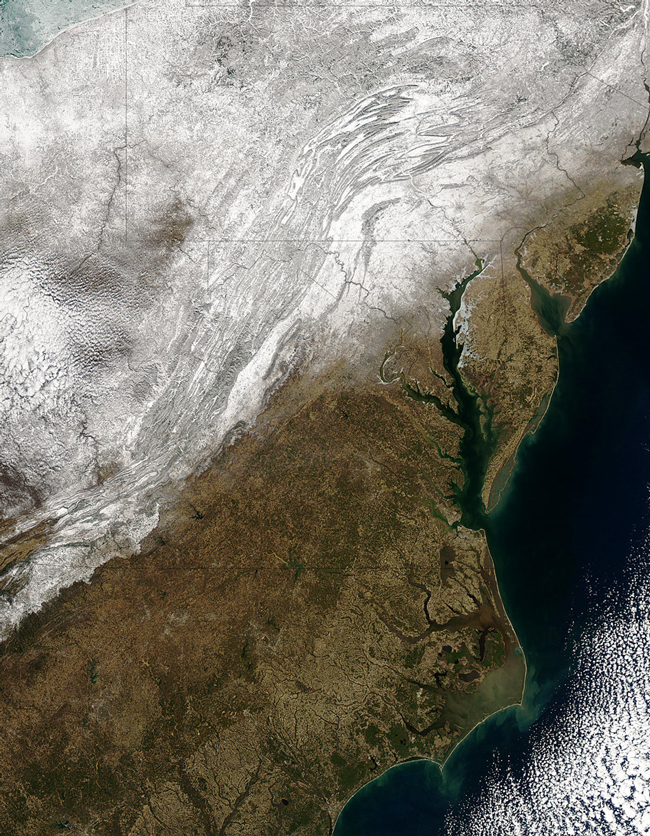
MODIS corresponding snow map of the Eastern United States, 8 February 2004.
Aqua MODIS true color image and corresponding snow map of the Eastern United States on the 8th of February 2004.
Snow continues to fall across the mid-Atlantic United States, turning the Appalachain Ranges into a mass of white and gray stripes, and limning shorelines with bright white ice. South of the Appalachians, the ground remains mostly bare, though low temperatures are a constant reminder of winter. In the upper right corner of the image, Lake Erie is covered in light blue ice, making it look similar to tumbled glass. This true-color Aqua MODIS image was acquired on February 8, 2004.
Text courtesy of NASA's MODIS Land Rapid Response Team.