A series of holiday snowstorms blanketed the central and northeastern United States with snow in late December 2007 and early January 2008. Many places in the Northeast received more than a foot of snow in a week's time. Several people were killed in traffic accidents, and road and air travel were interrupted across the country.
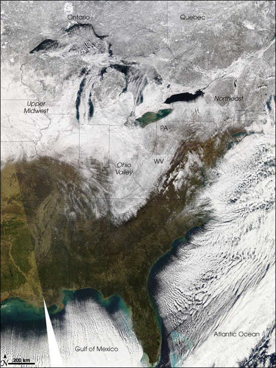
This image from the Moderate Resolution Imaging Spectroradiometer (MODIS) on NASA's Aqua satellite shows the eastern United States on January 2, 2008, after the latest storm passed over. Two satellite overpasses have been stitched together to create the image. Snow covers the ground in the Upper Midwest, the Ohio Valley, Mid-Atlantic states West Virginia and Pennsylvania, and the Northeast. Despite a succession of December snowstorms, the temperatures had not dropped enough to freeze the Great Lakes, whose clear blue waters are overlaid with clouds. Cold air blowing southeast over the United States picks up moisture over the Gulf of Mexico (bottom center) and the Atlantic Ocean (bottom right), creating parallel ribbons of clouds.
The large image provided above has a spatial resolution (level of detail) of 1 kilometer per pixel, and it shows the entire United States. The MODIS Rapid Response Team provides twice-daily images of sub-regions of the United States in additional resolutions via a clickable map.
Text and image courtesy of NASA's Earth Observatory.