
More Information
view allVideos
Videos

The Winter of 2013 – 2014: A Cold, Snowy and Icy Winter in North America
This animation shows the snow cover over North America during the 2013-2014 winter as well as the ice concentration over the Great Lakes. The date and a graph showing the percent of ice cover over the Great Lakes and Lake Superior is shown on this version. file size is 5.2 MB
Snow Cover & Sea Ice Animation
This animation shows the advance and retreat of daily snow cover along with daily sea ice surface temperature globally from September 2002 through May 2003. file size is 31MB
Surface Temperature of the Greenland Ice Sheet During the Summer of 2005
This animation shows daily surface temperature of the Greenland ice sheet from May 1 through September 1, 2005. An overlay contains a date bar, a color bar and text labels. file size is 14MB
Daily Snow and Sea Ice Temperature over the North Pole
This animation shows the daily advance and retreat of snow cover, and sea ice surface temperature over the North Pole during the winter of 2002-2003. file size is 31MB
Daily Snow and Sea Ice Temperature over North America
This animation shows the daily advance and retreat of snow cover, and sea ice surface temperature over North America during the winter of 2002-2003. file size is 15MB
Daily Snow and Sea Ice Temperature over Europe
This animation shows the daily advance and retreat of snow cover, and sea ice surface temperature over Europe during the winter of 2002-2003. file size is 31MB
Daily Snow and Sea Ice Temperature over Asia
This animation shows the daily advance and retreat of snow cover, and sea ice surface temperature over Asia during the winter of 2002-2003. file size is 7MB


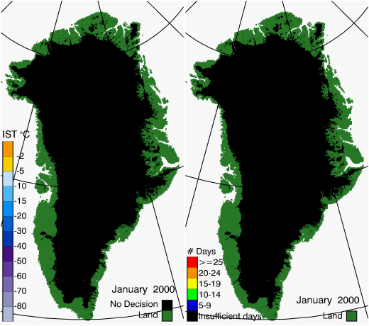
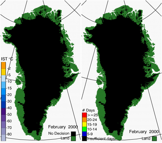
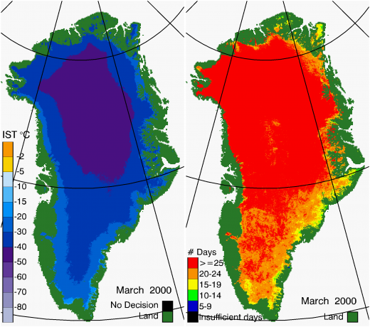
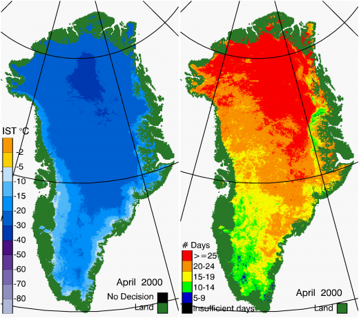
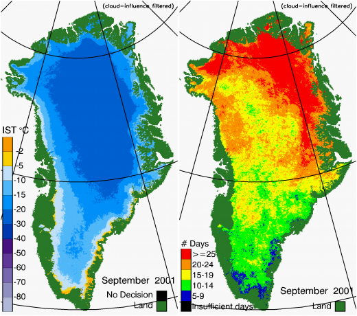
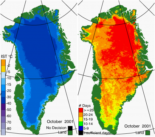
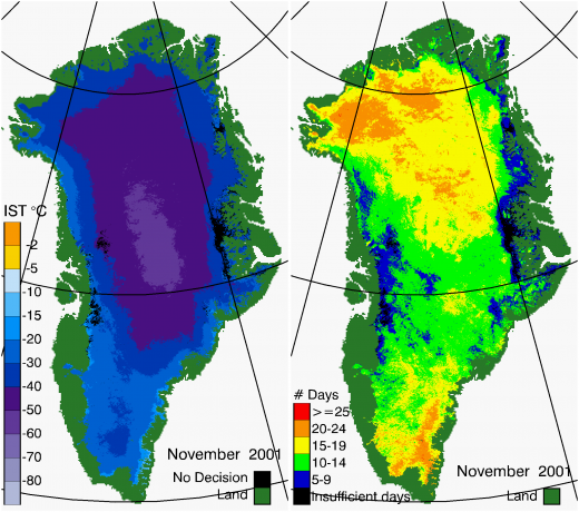
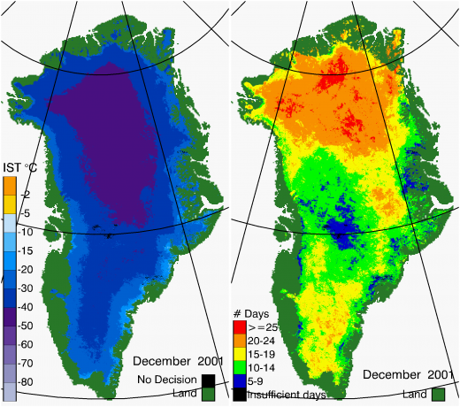
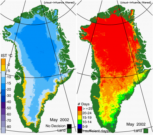
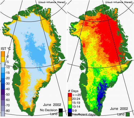
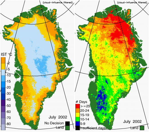
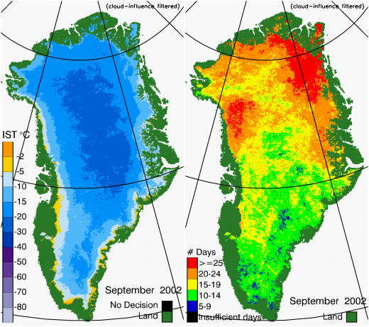
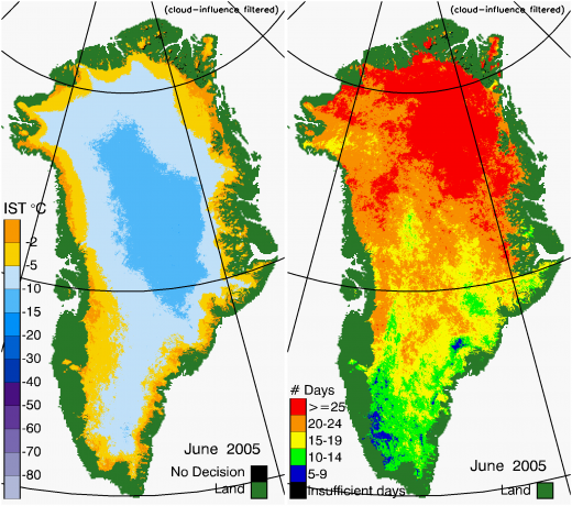
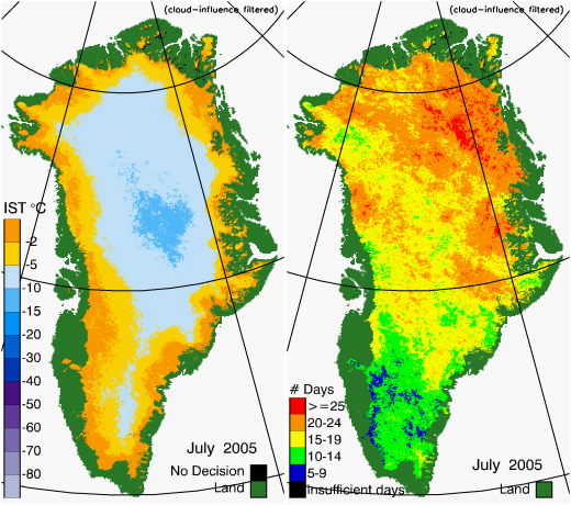
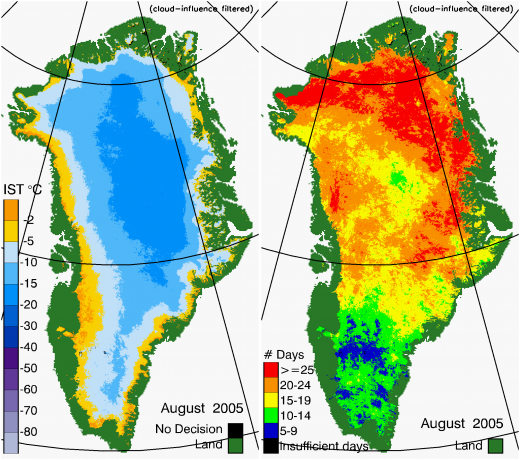
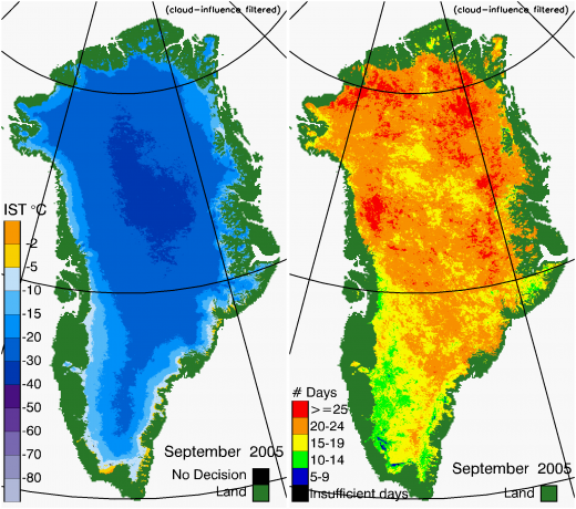
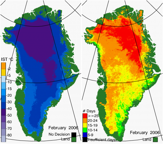
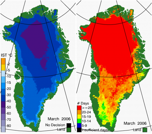
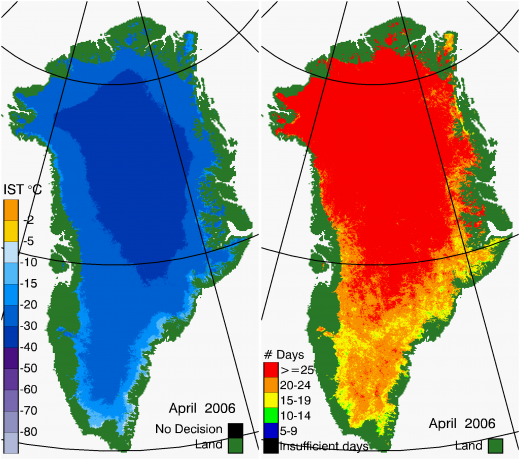
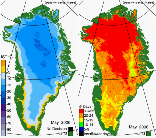
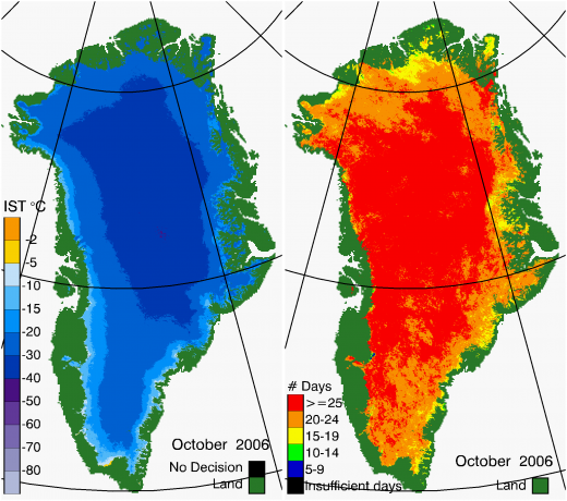
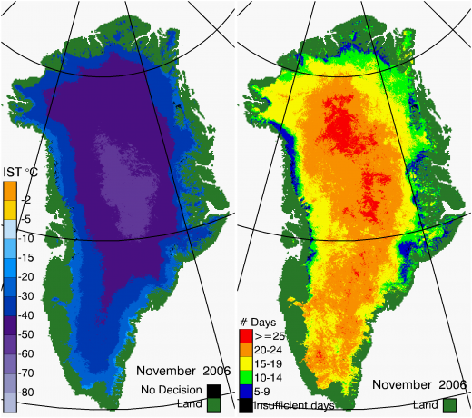
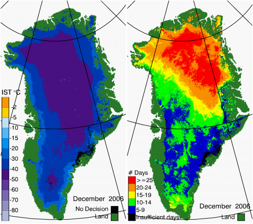
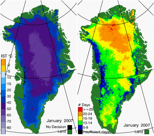
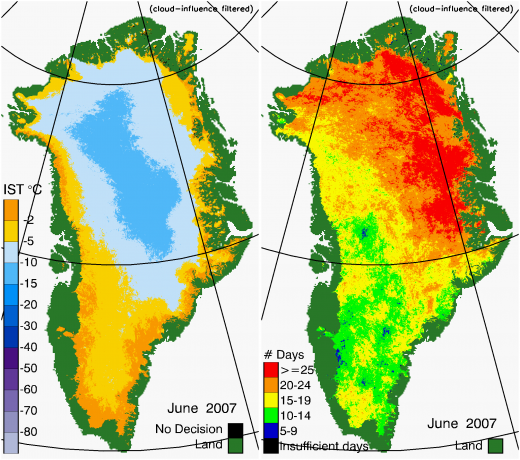
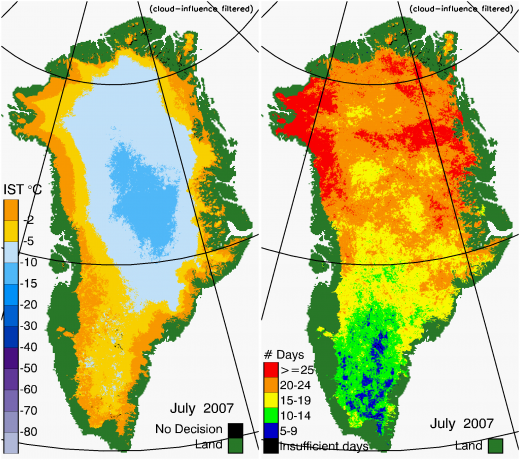
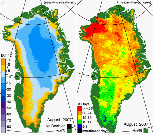
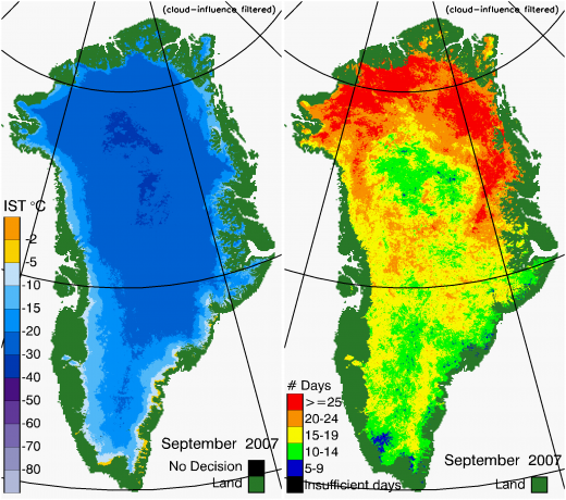
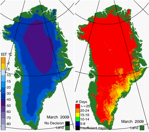
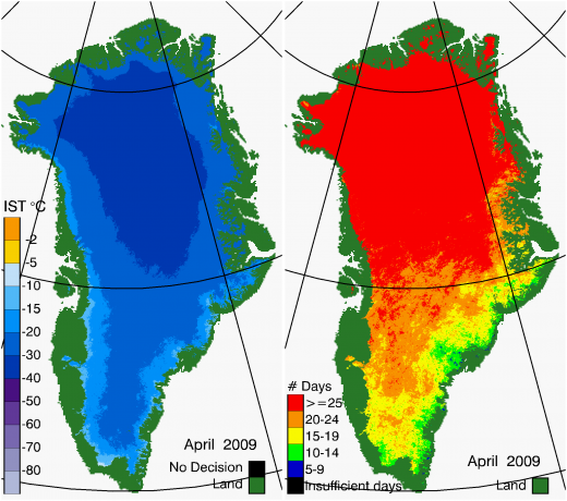
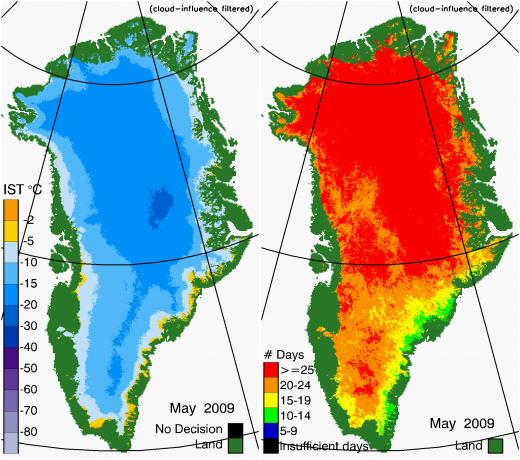
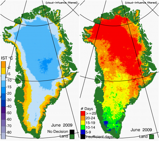
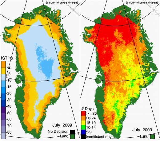
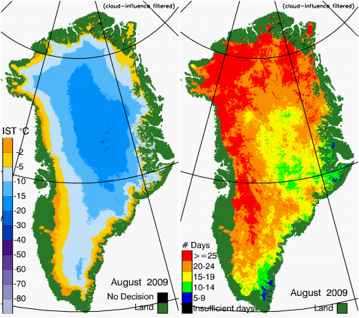
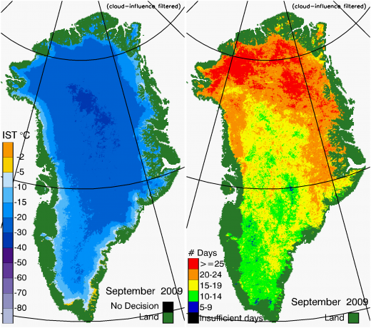
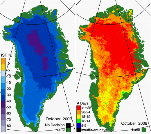
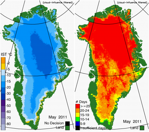
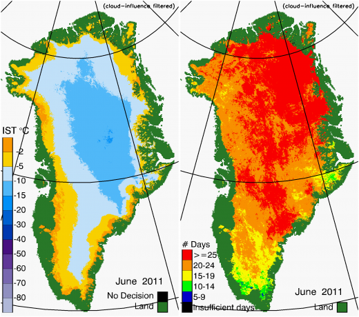
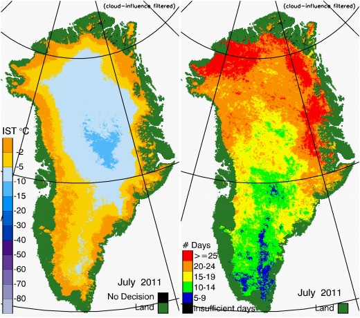
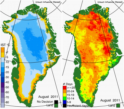
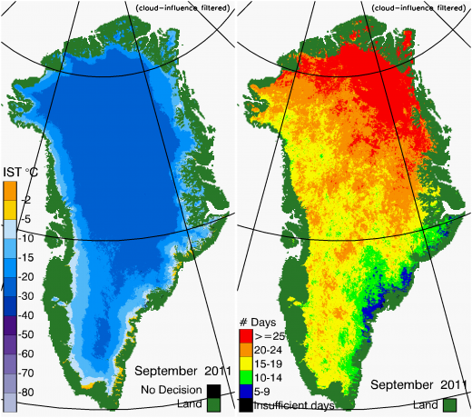
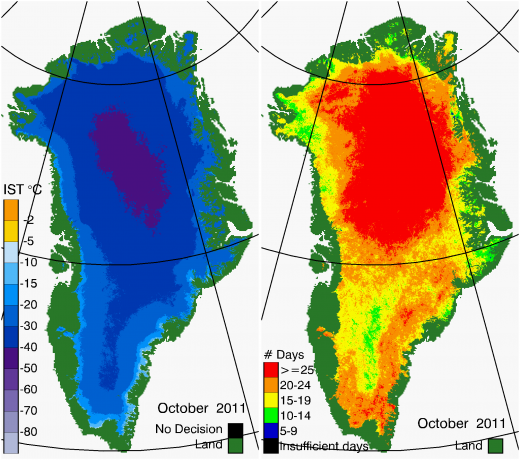
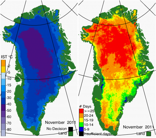
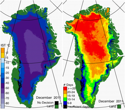
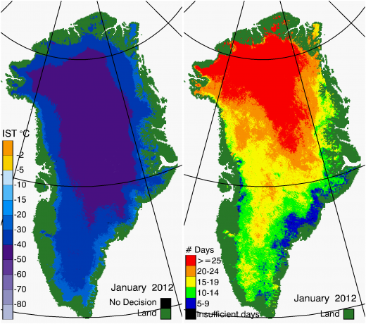
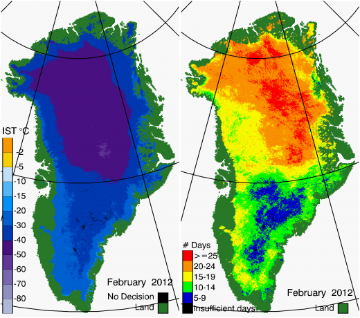
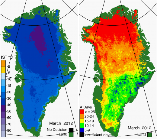
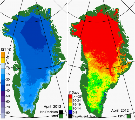
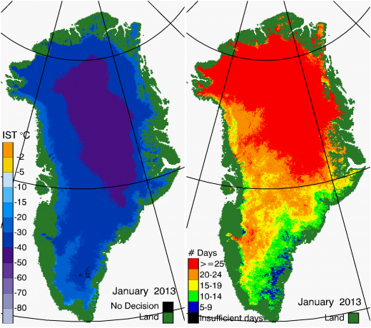
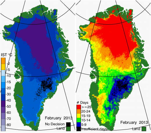
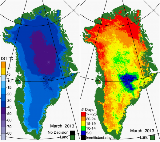
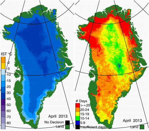
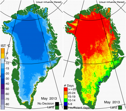
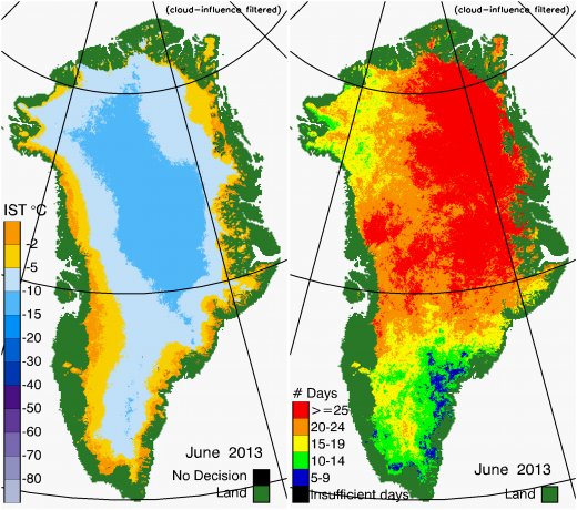
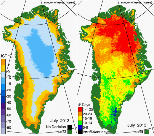
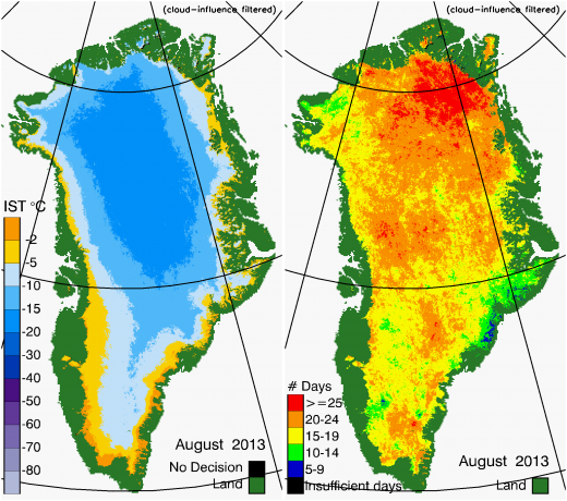
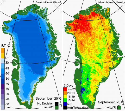
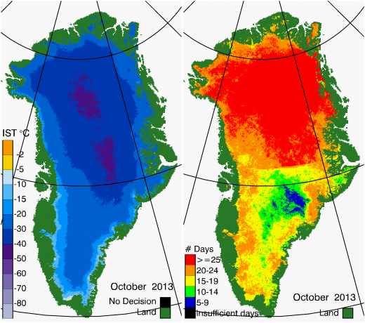
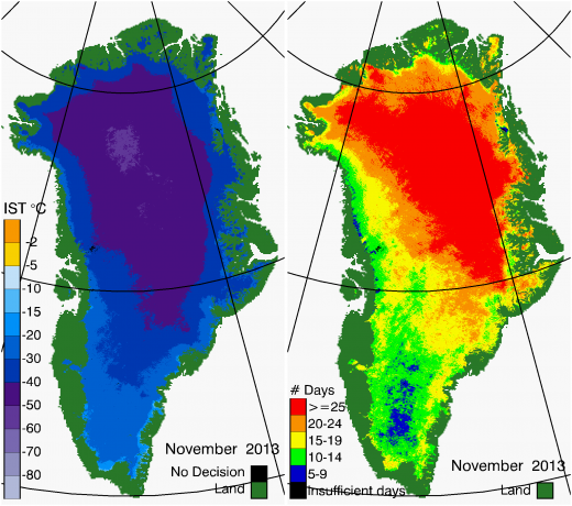
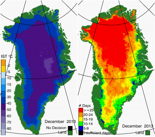
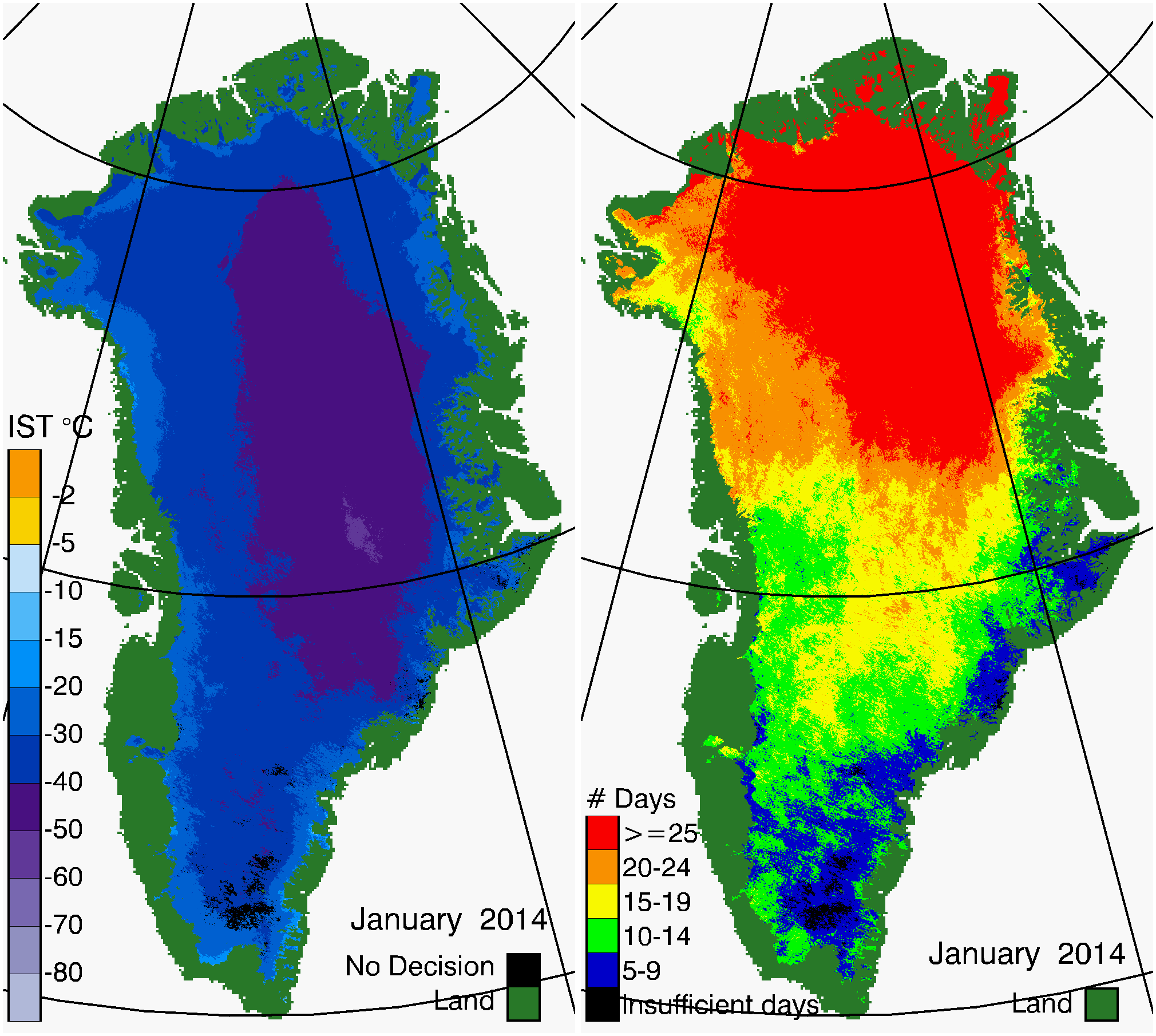
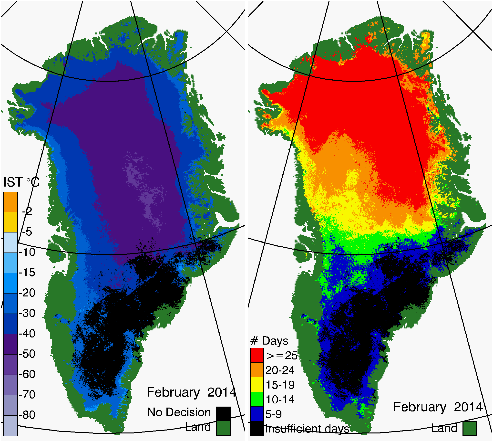
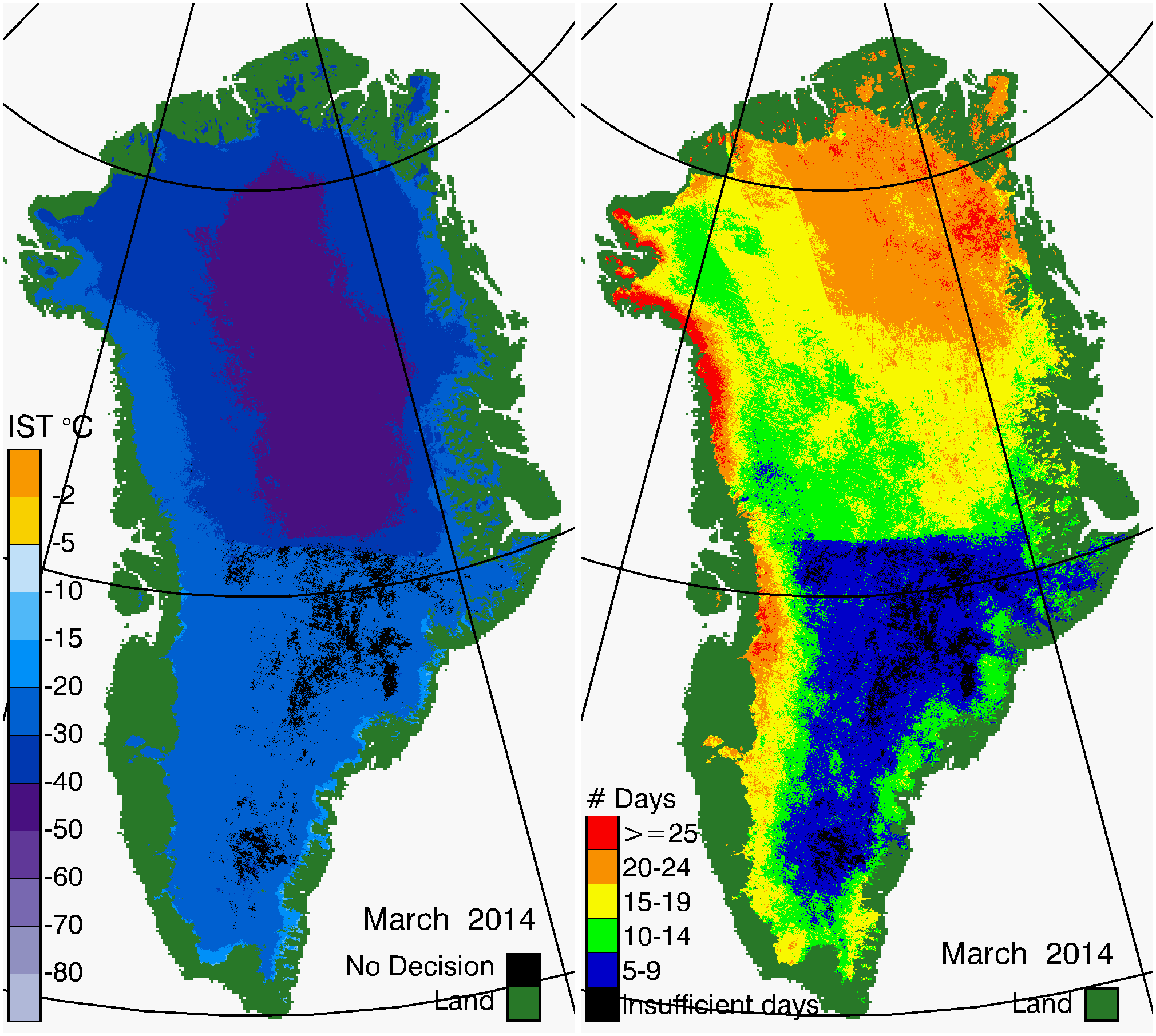
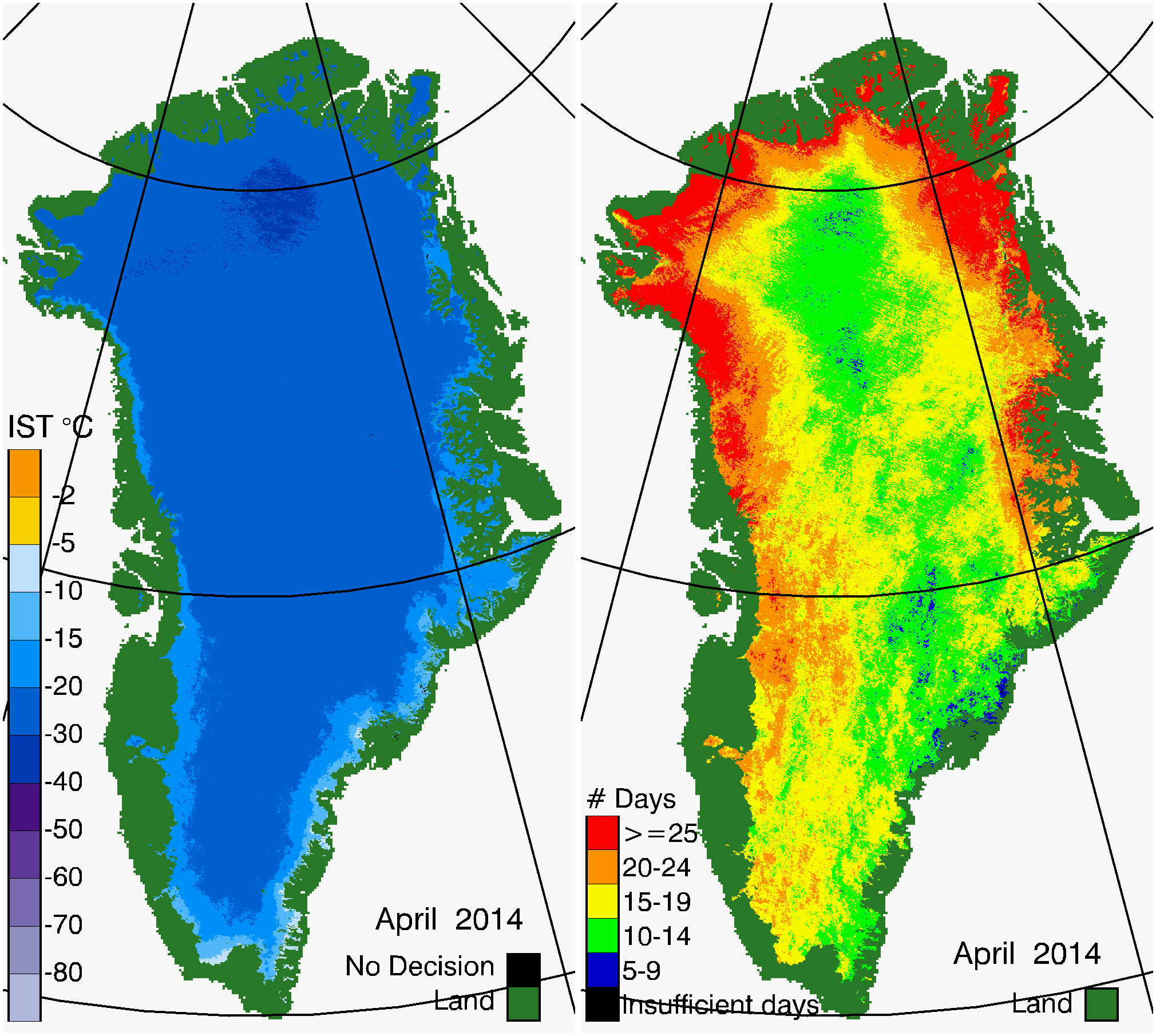
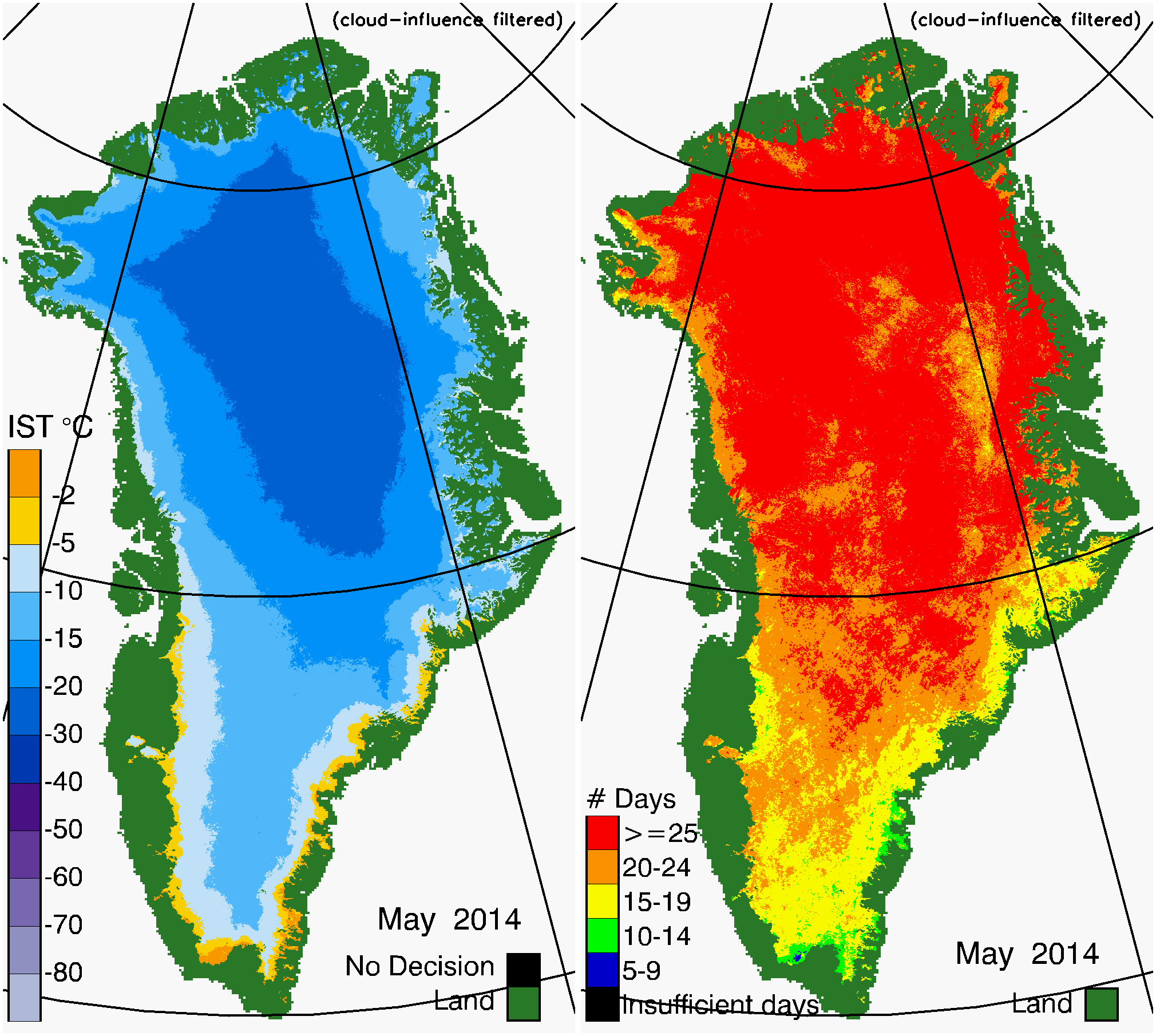
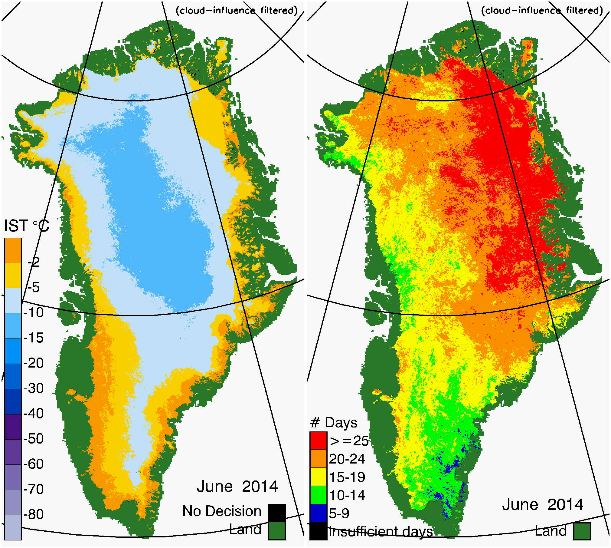
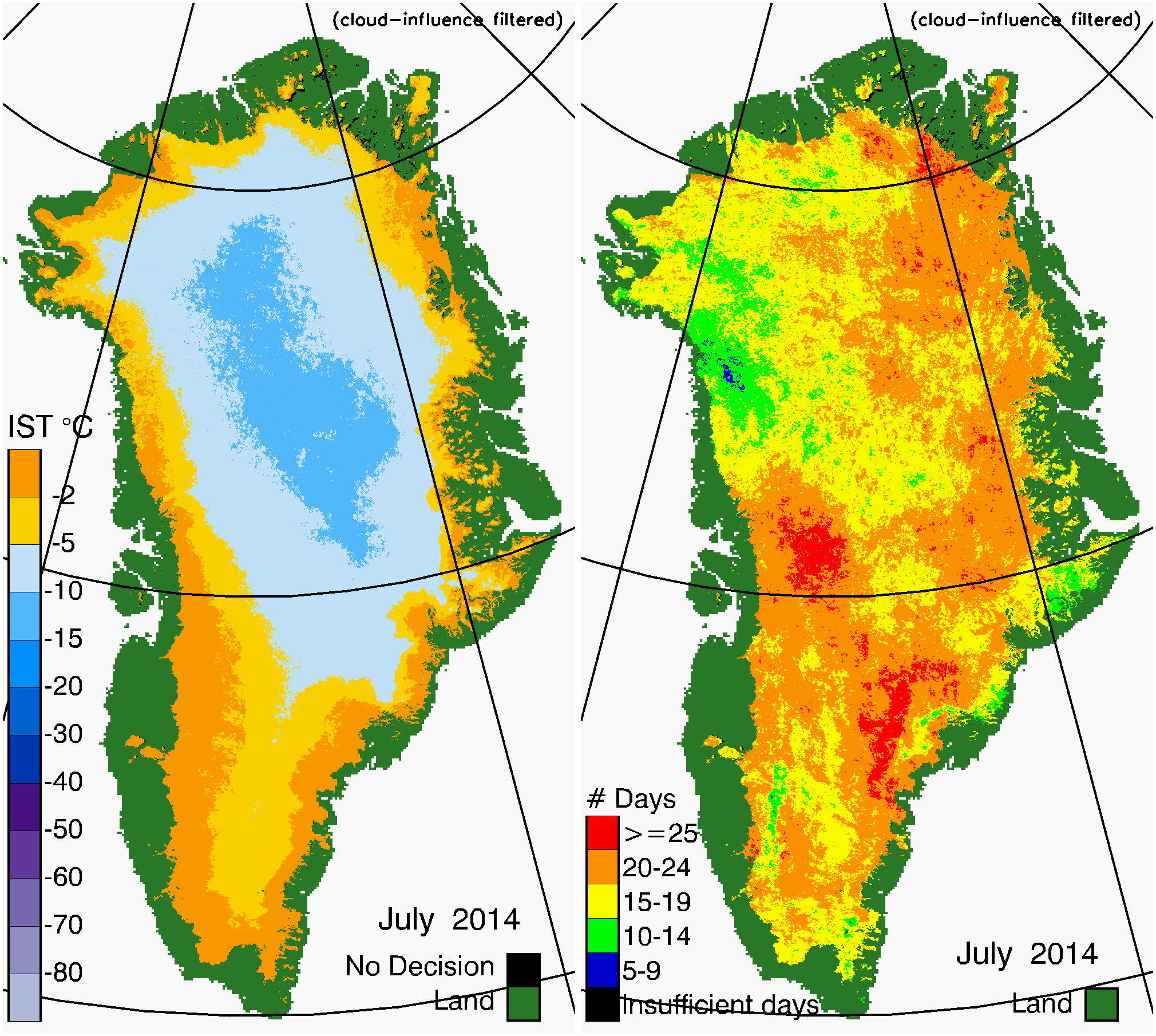
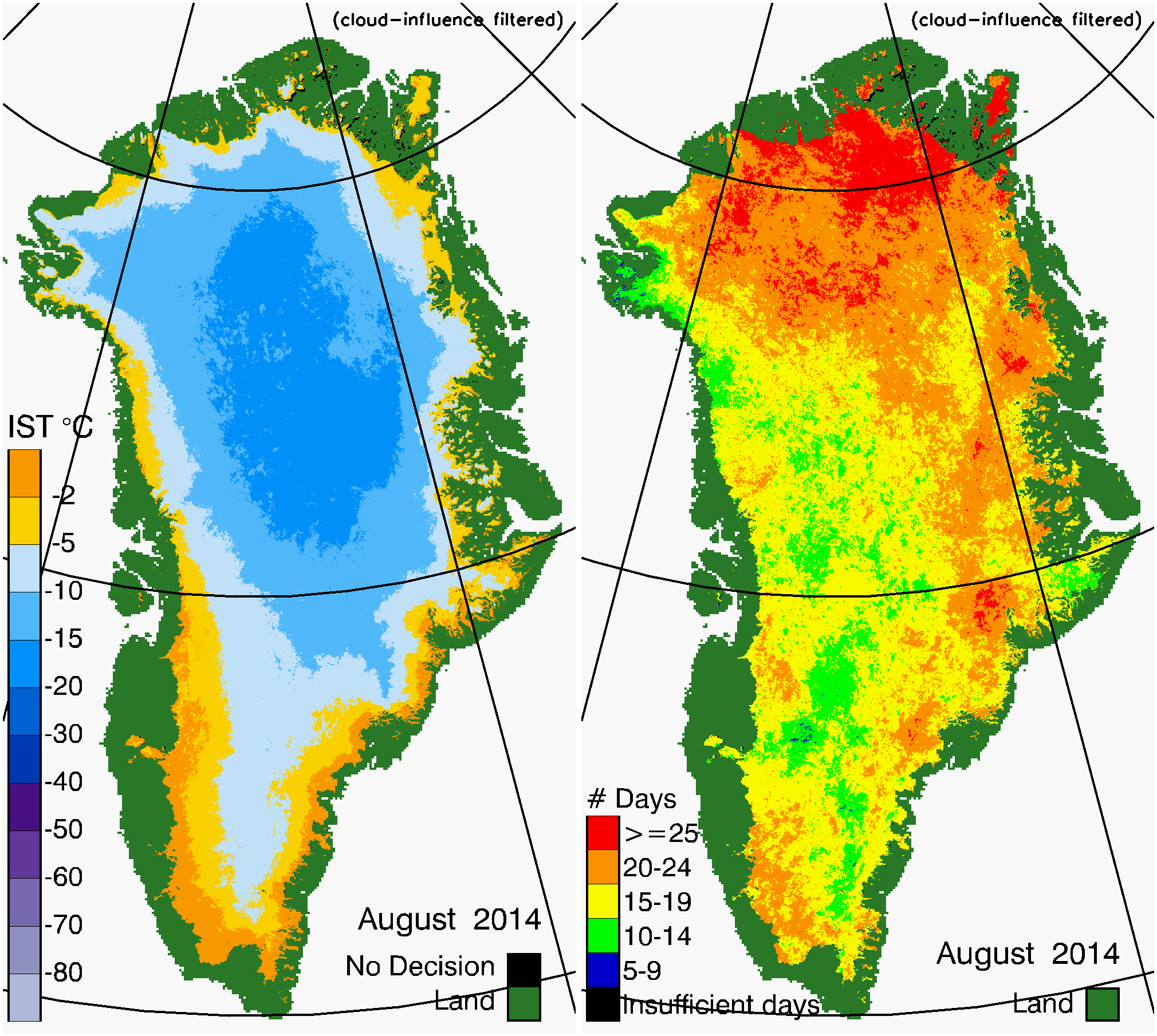
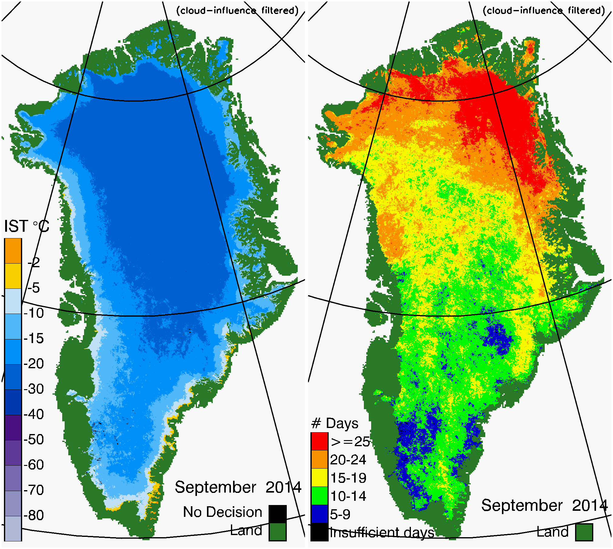
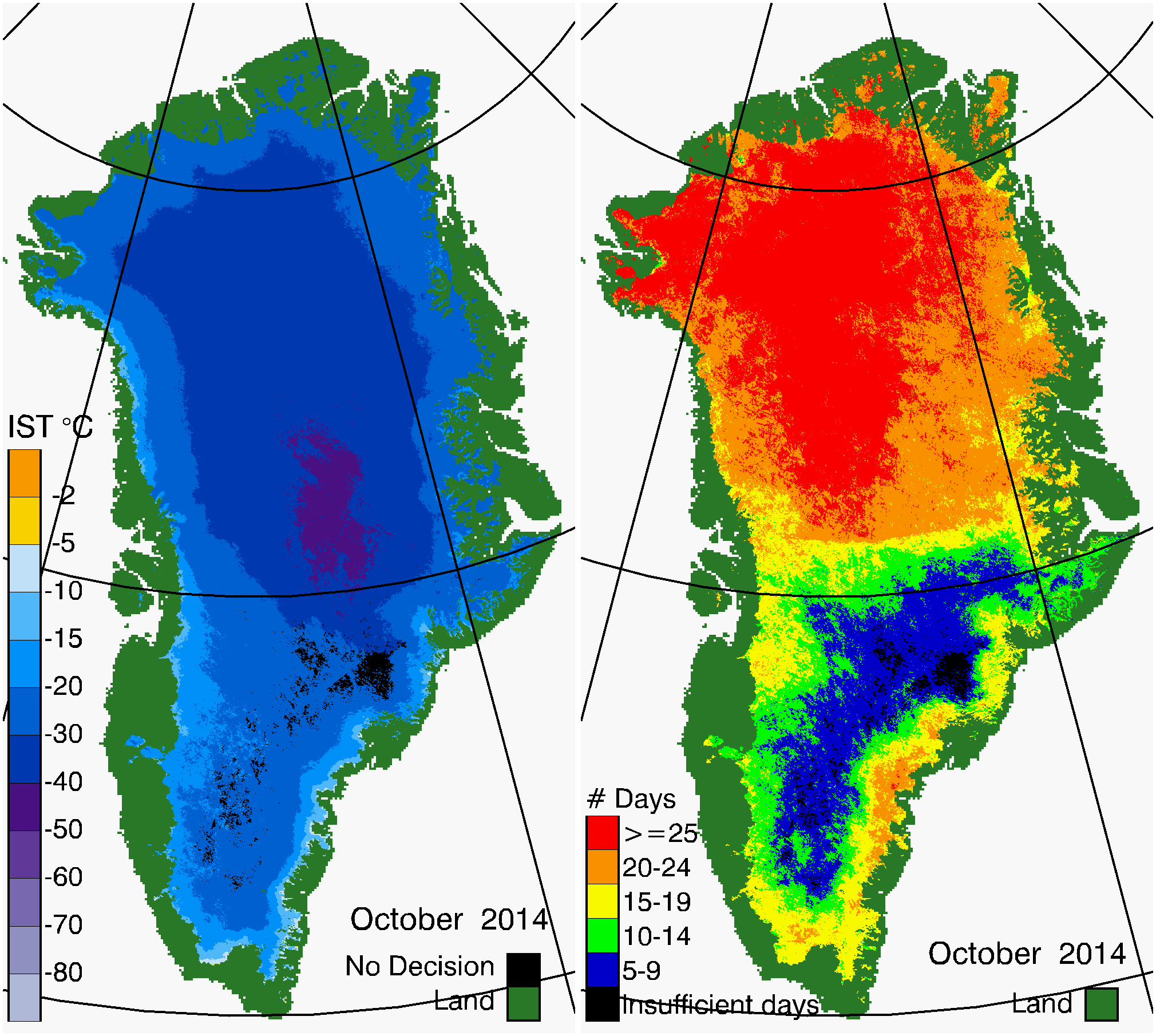
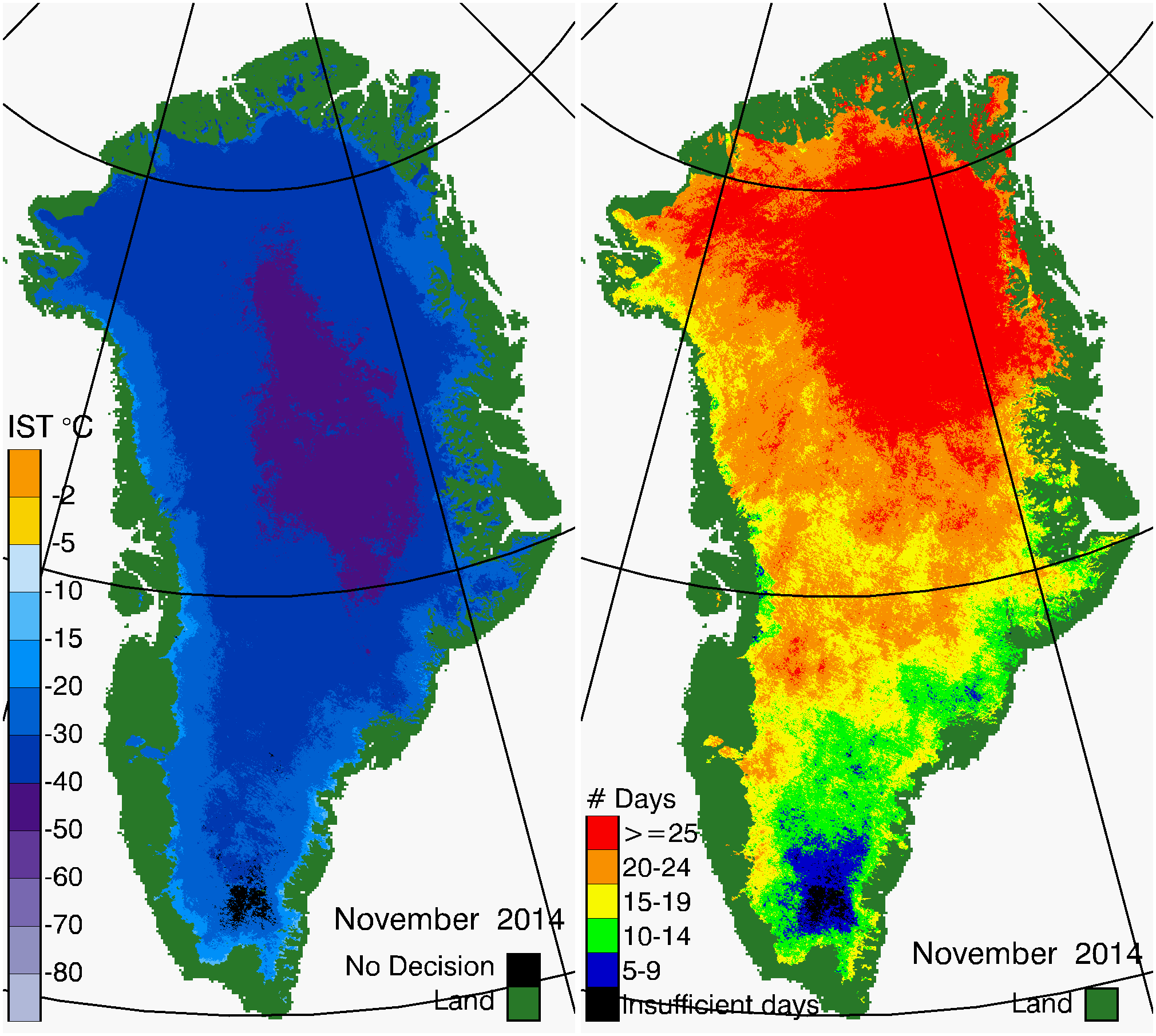
Multilayer Greenland Ice Surface Temperature, Surface Albedo, and Water Vapor from MODIS, 2000-2019
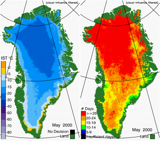
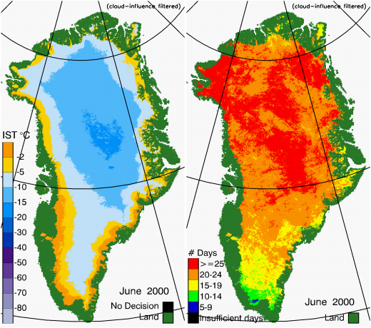
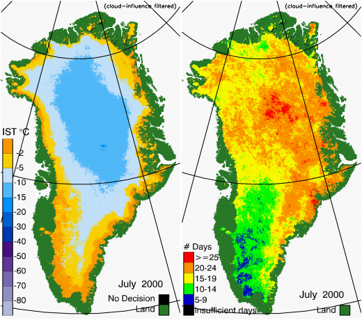
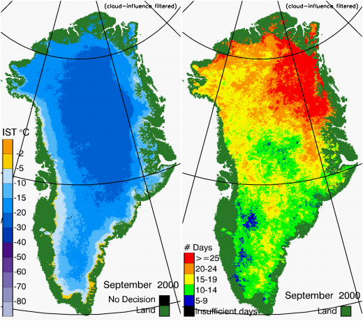
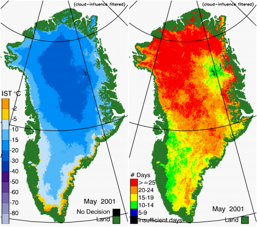
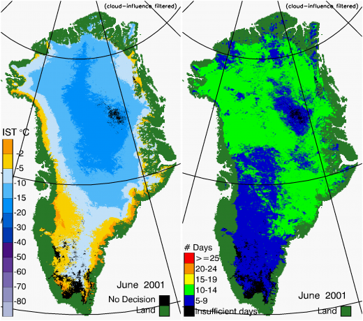
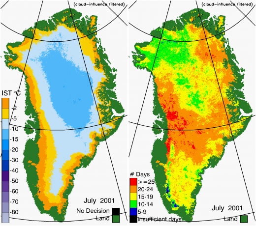
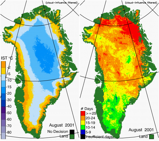
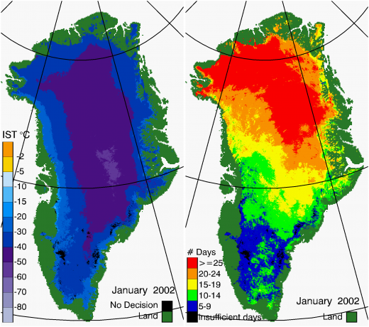
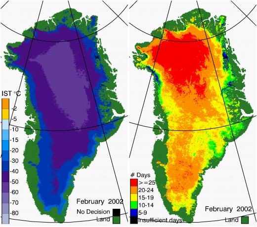
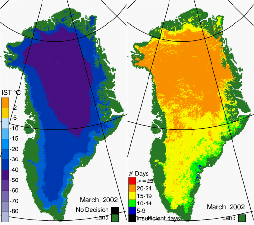
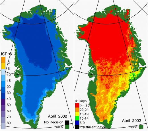
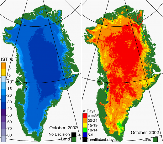
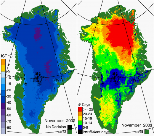
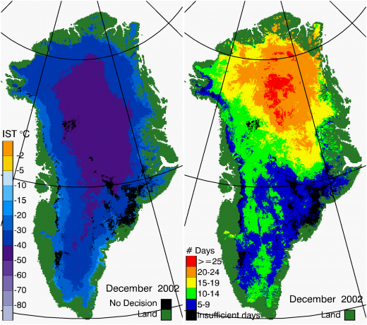
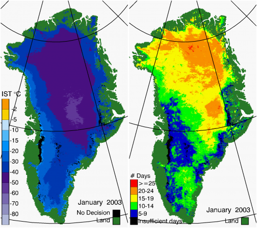
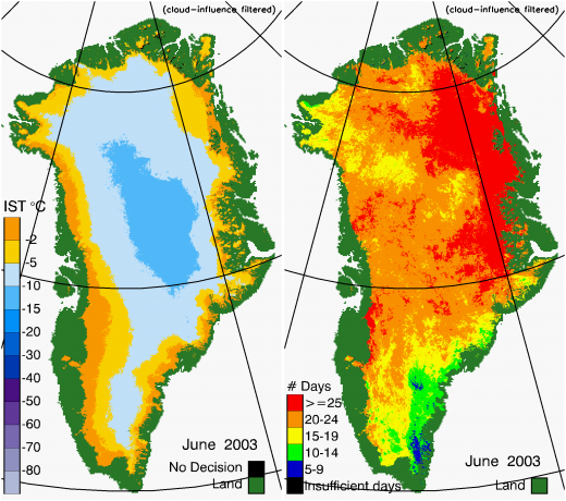
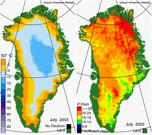
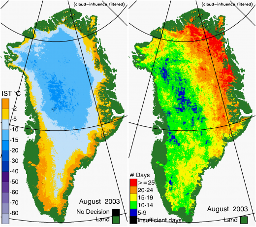
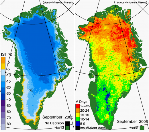
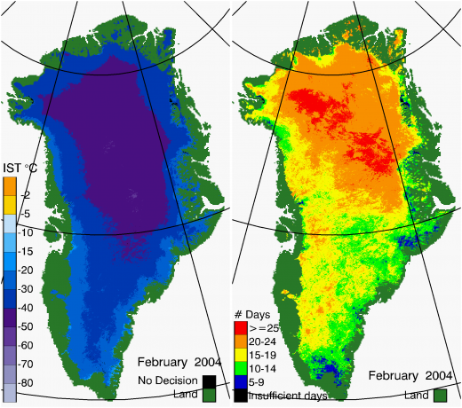
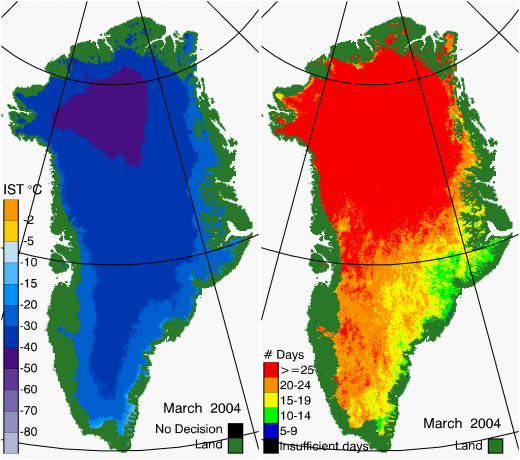
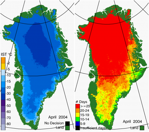
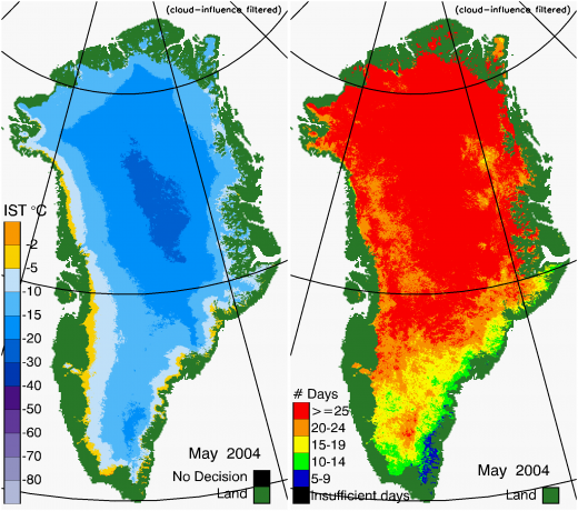
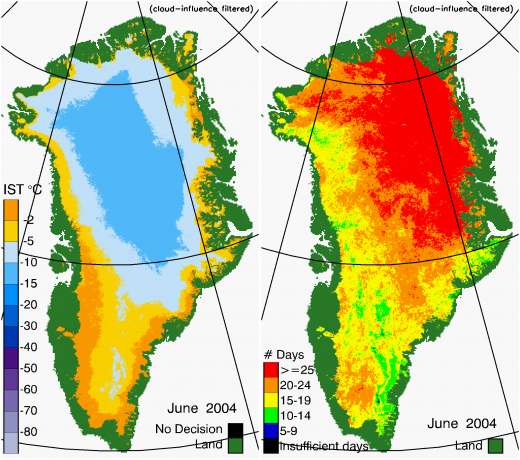
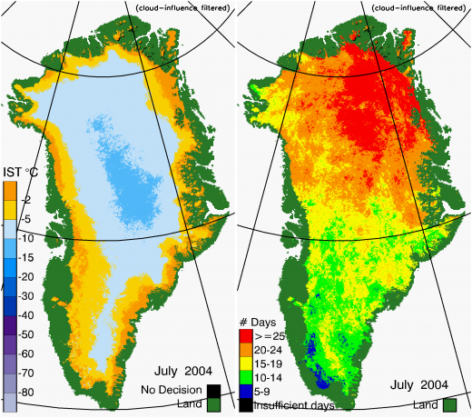
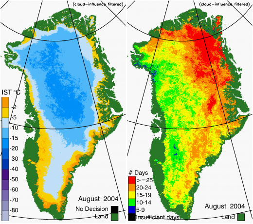
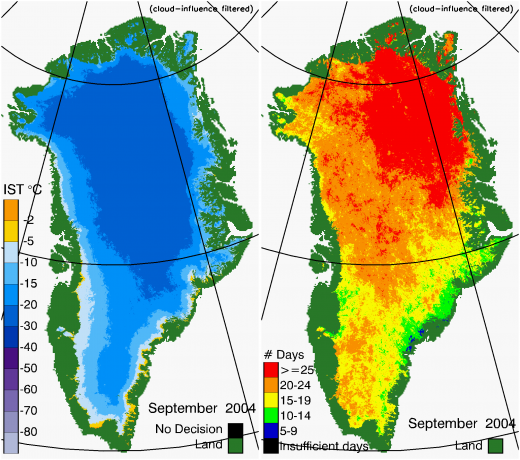
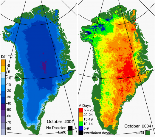
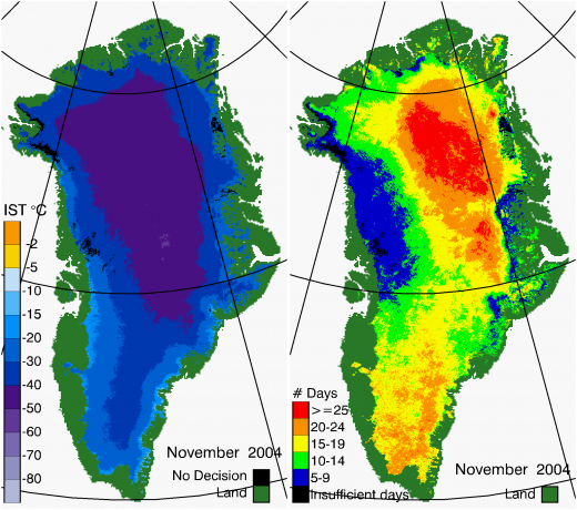
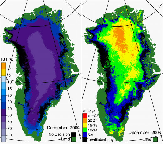
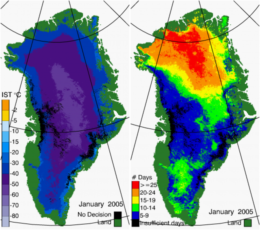
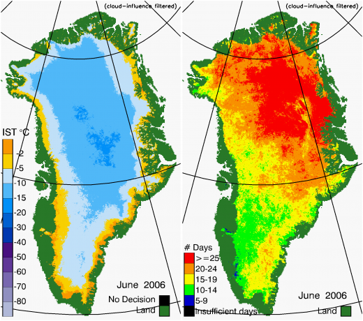
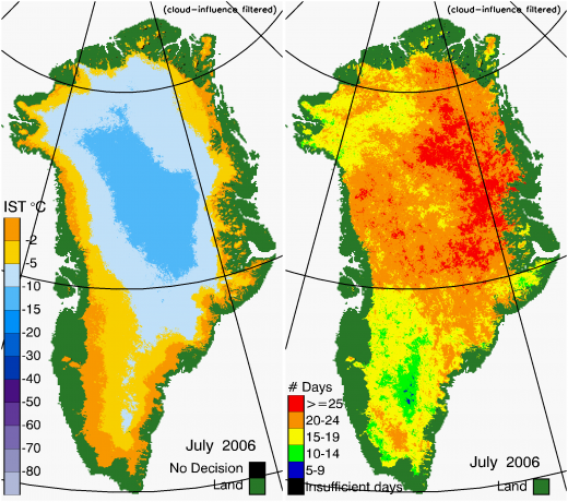
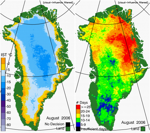
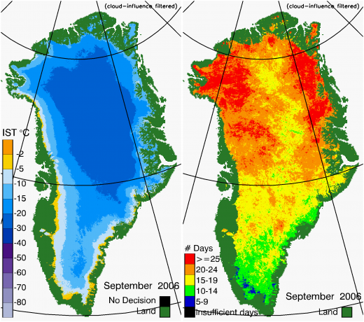
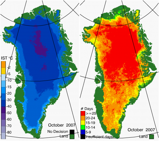
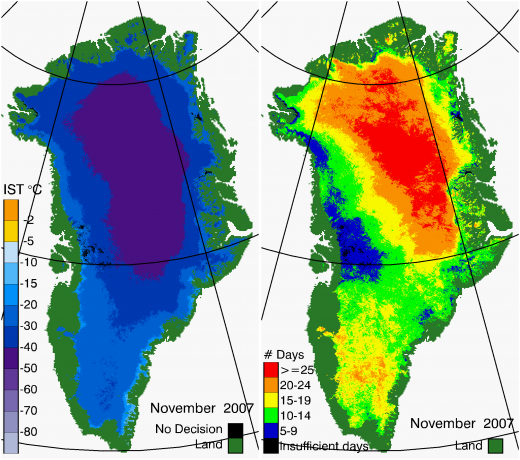
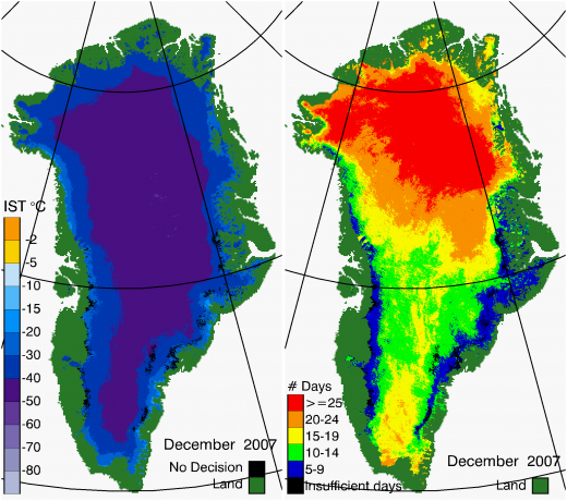
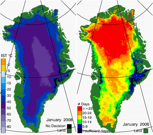
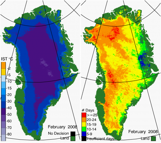
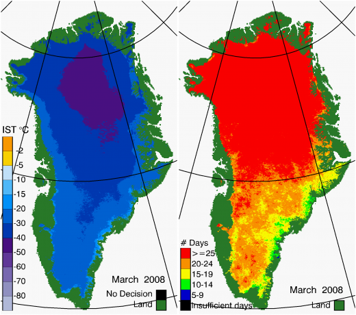
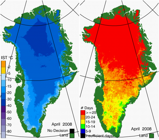
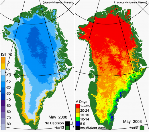
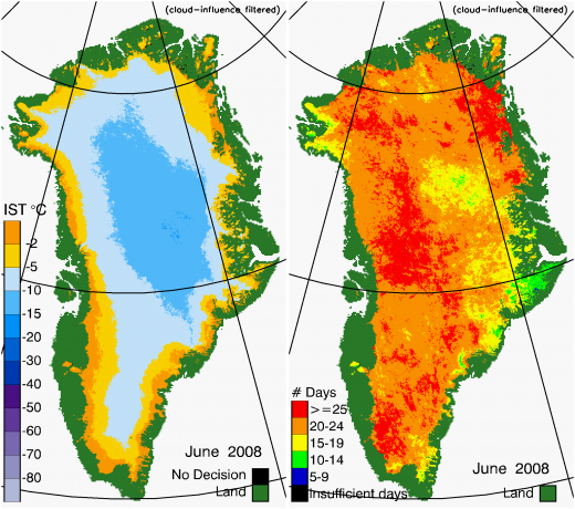
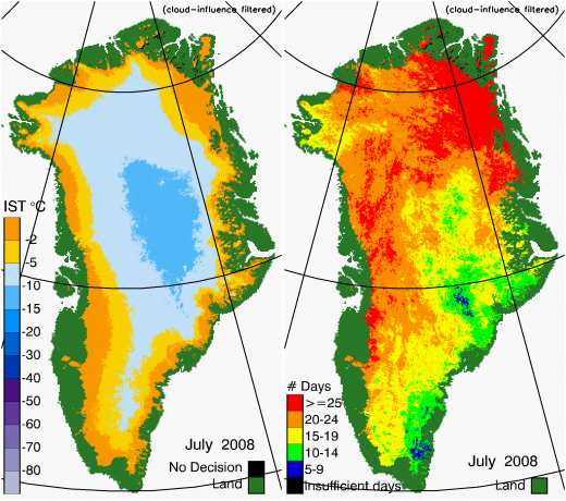
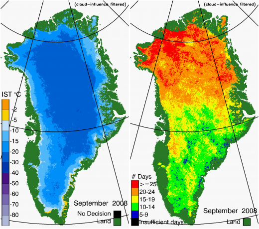
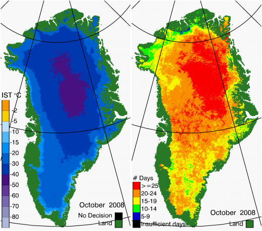
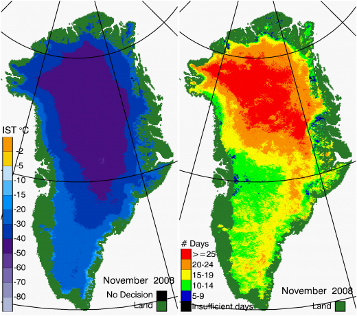
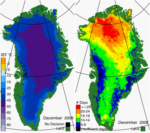
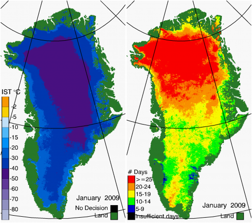
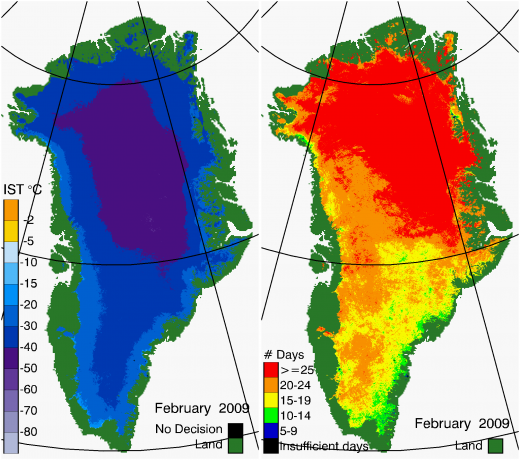
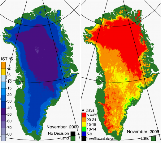
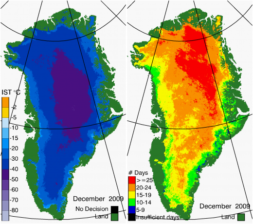
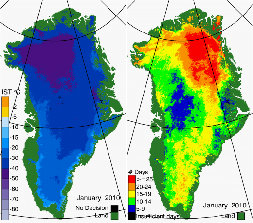
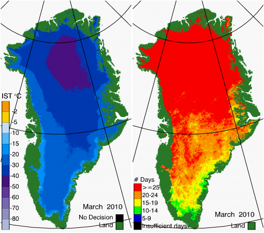
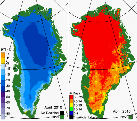
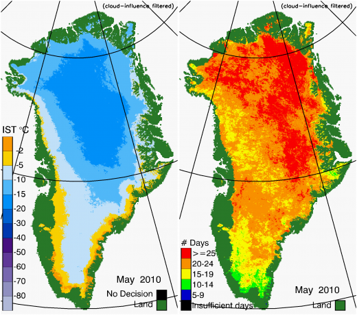
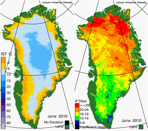
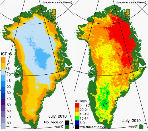
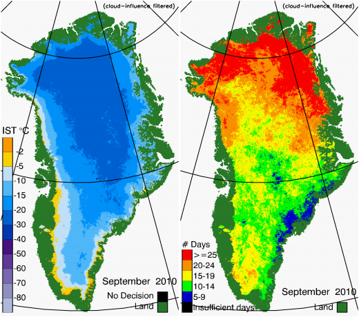
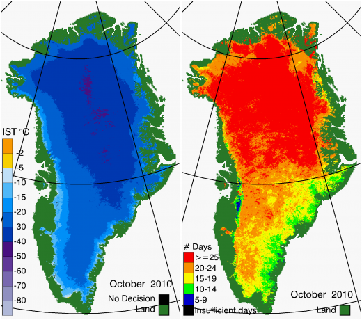
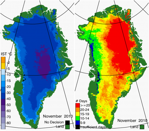
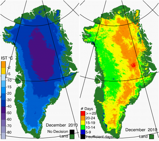
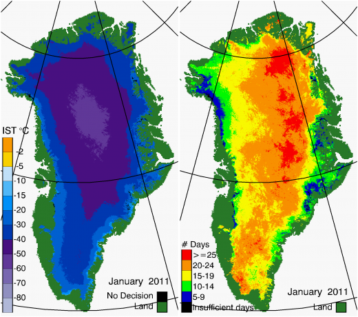
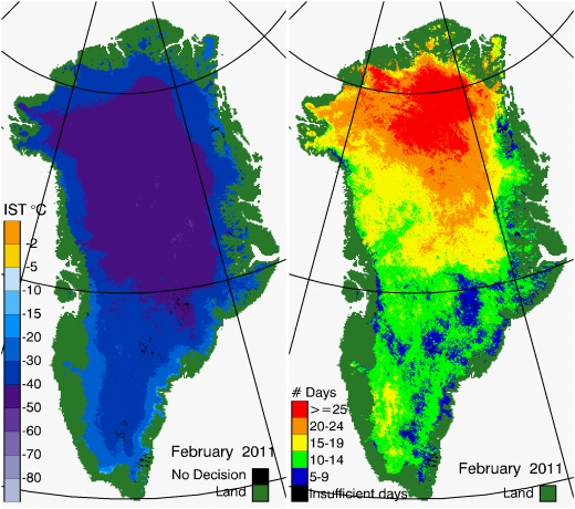
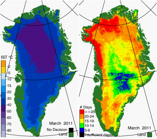
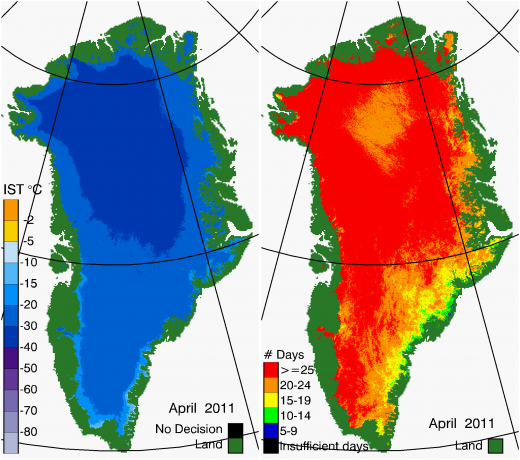
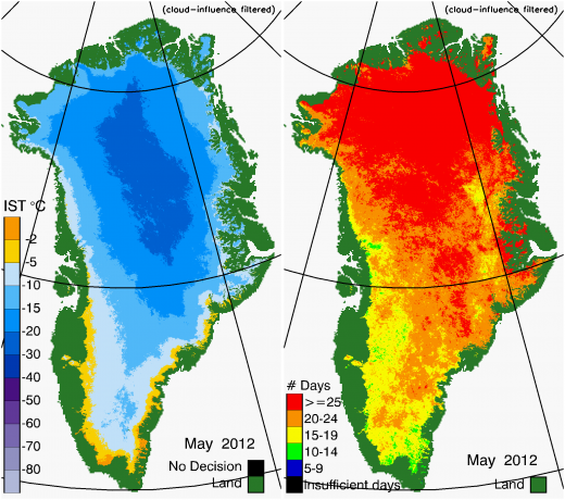
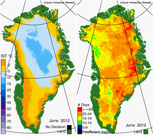
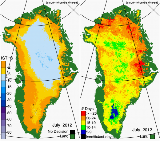
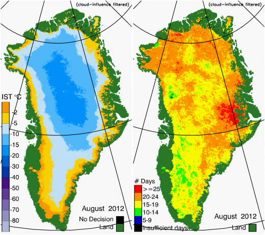
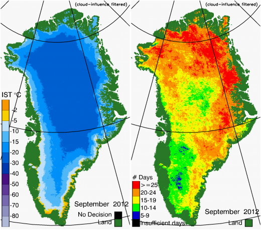
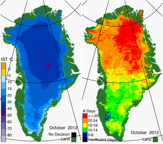
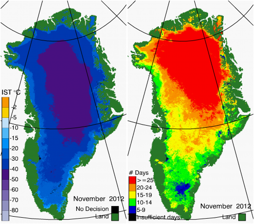
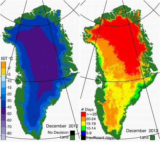
This multilayer data set includes standard MODIS Collection 6.1 ice surface temperature (IST) and derived melt maps, as well as MODIS Collection 6.0 albedo and water vapor for Greenland, at a spatial resolution of 0.78 km, derived from the Terra MODIS instrument. Also included is an ice mask and a basins mask for delineating drainage basins in Greenland. The dataset is described at NSIDC and in the following publication:
- Hall, D.K., Cullather, R.I., Comiso, J.C., DiGirolamo, N.E., Nowicki, S.M and B.C. Medley. 2018. A multilayer IST – albedo product of Greenland from MODIS. Remote Sensing [Special Issue: Remote Sensing of Essential Climate Variables and their Applications], 10(4): 555, https://doi:10.3390/rs10040555.
The complete dataset is available from the National Snow and Ice Data Center at the following URL: https://nsidc.org/data/modgrnld/versions/1
Some samples of an earlier version of the IST maps are provided below.
Contact Dorothy Hall for more information.
2000 |
2001 |
2002 |
2003 |
2004 |
2005 |
2006 |
2007 |
2008 |
2009 |
2010 |
2011 |
2012 |
2013 |
2014
Jan. 2000
Feb. 2000
Mar. 2000
Apr. 2000
May 2000
Jun. 2000
Jul. 2000
Aug. 2000

Sep. 2000
Oct. 2000

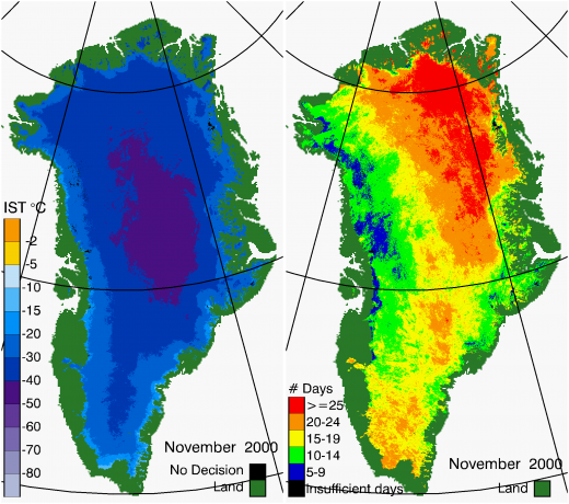
Nov. 2000
Dec. 2000

Jan. 2001

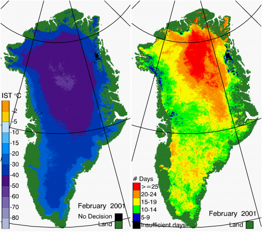
Feb. 2001
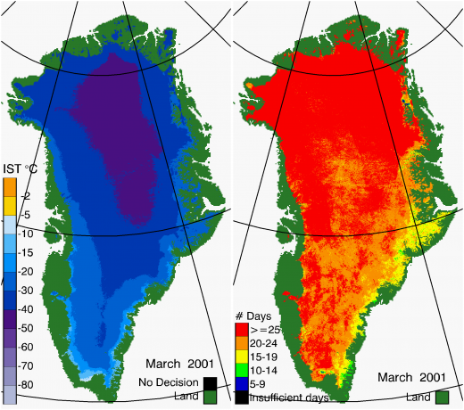
Mar. 2001
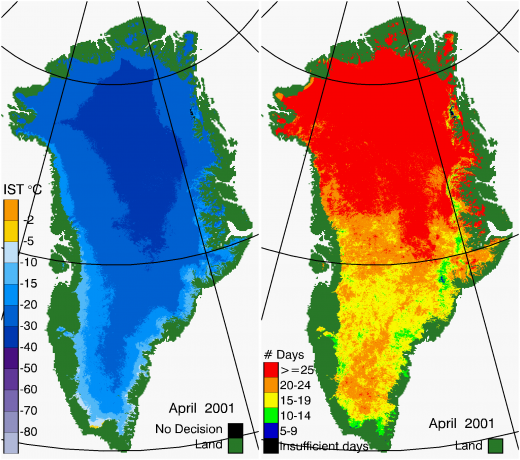
Apr. 2001
May 2001
Jun. 2001
Jul. 2001
Aug. 2001
Sep. 2001
Oct. 2001
Nov. 2001
Dec. 2001
Jan. 2002
Feb. 2002
Mar. 2002
Apr. 2002
May 2002
Jun. 2002
Jul. 2002
Aug. 2002

Sep. 2002
Oct. 2002
Nov. 2002
Dec. 2002
Jan. 2003
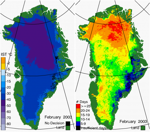
Feb. 2003
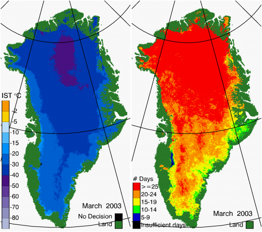
Mar. 2003
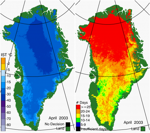
Apr. 2003
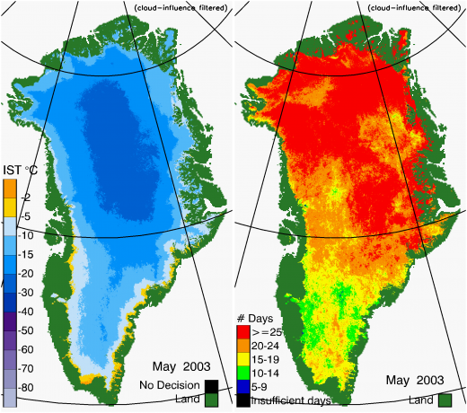
May 2003
Jun. 2003
Jul. 2003
Aug. 2003
Sep. 2003
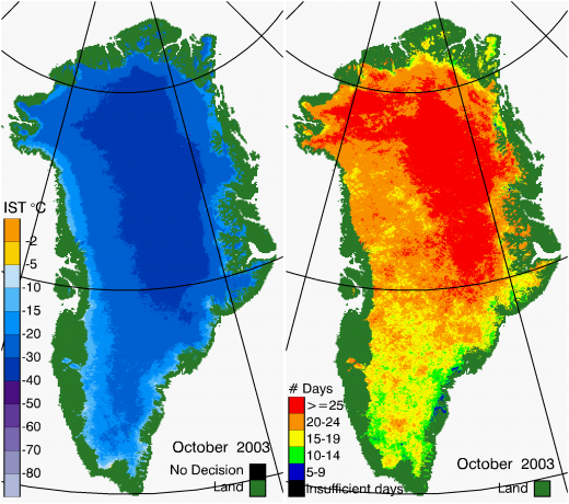
Oct. 2003
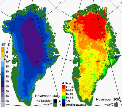
Nov. 2003
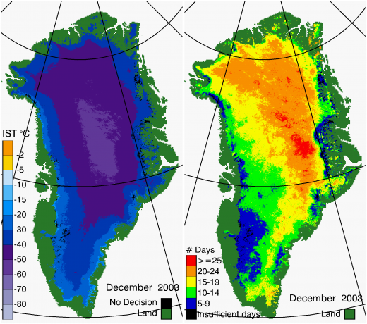
Dec. 2003
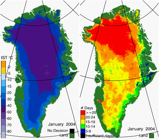
Jan. 2004
Feb. 2004
Mar. 2004
Apr. 2004
May 2004
Jun. 2004
Jul. 2004
Aug. 2004
Sep. 2004
Oct. 2004
Nov. 2004
Dec. 2004
Jan. 2005
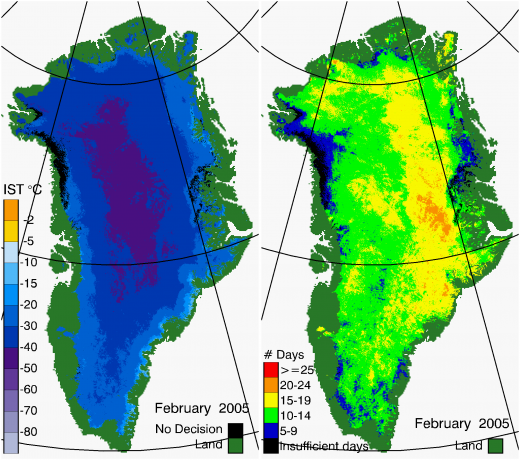
Feb. 2005
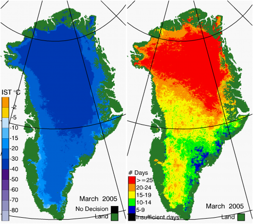
Mar. 2005
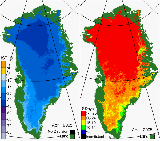
Apr. 2005
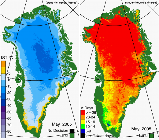
May 2005
Jun. 2005
Jul. 2005
Aug. 2005
Sep. 2005
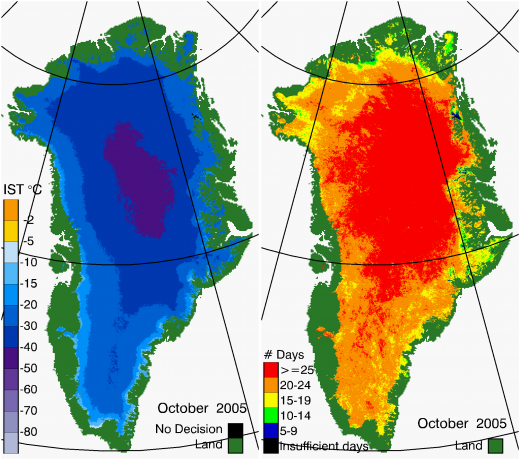
Oct. 2005
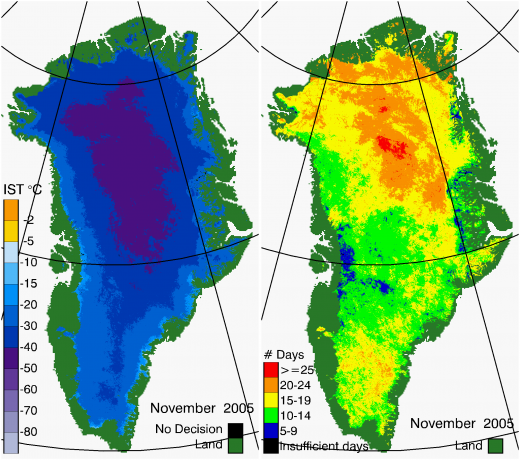
Nov. 2005
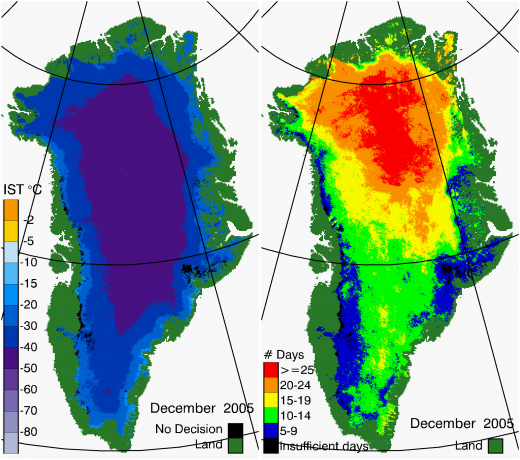
Dec. 2005
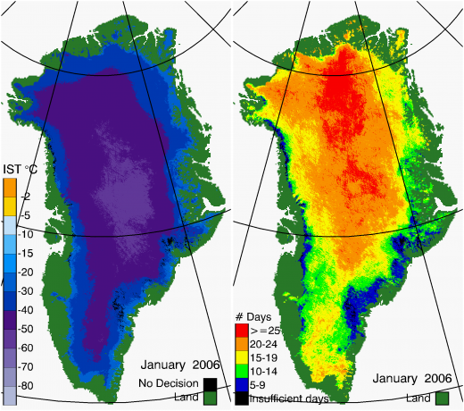
Jan. 2006
Feb. 2006
Mar. 2006
Apr. 2006
May 2006
Jun. 2006
Jul. 2006
Aug. 2006
Sep. 2006
Oct. 2006
Nov. 2006
Dec. 2006
Jan. 2007
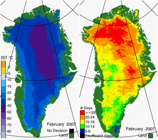
Feb. 2007
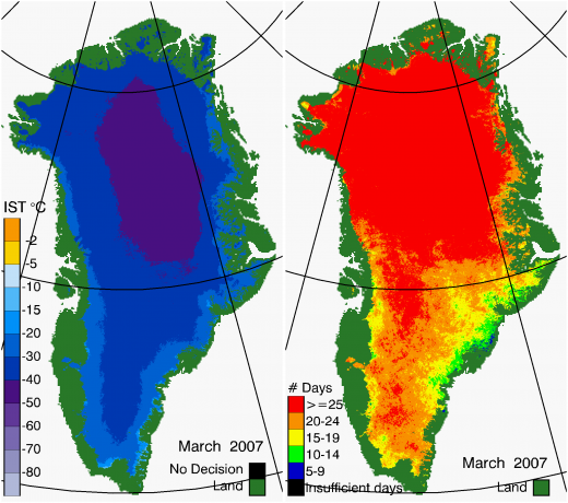
Mar. 2007
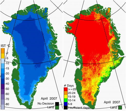
Apr. 2007
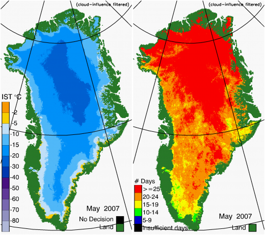
May 2007
Jun. 2007
Jul. 2007
Aug. 2007
Sep. 2007
Oct. 2007
Nov. 2007
Dec. 2007
Jan. 2008
Feb. 2008
Mar. 2008
Apr. 2008
May 2008
Jun. 2008
Jul. 2008
Aug. 2008

Sep. 2008
Oct. 2008
Nov. 2008
Dec. 2008
Jan. 2009
Feb. 2009
Mar. 2009
Apr. 2009
May 2009
Jun. 2009
Jul. 2009
Aug. 2009
Sep. 2009
Oct. 2009
Nov. 2009
Dec. 2009
Jan. 2010
Feb. 2010

Mar. 2010
Apr. 2010
May 2010
Jun. 2010
Jul. 2010
Aug. 2010

Sep. 2010
Oct. 2010
Nov. 2010
Dec. 2010
Jan. 2011
Feb. 2011
Mar. 2011
Apr. 2011
May 2011
Jun. 2011
Jul. 2011
Aug. 2011
Sep. 2011
Oct. 2011
Nov. 2011
Dec. 2011
-
Jan. 2012
-
Feb. 2012
-
Mar. 2012
-
Apr. 2012
-
May 2012
-
Jun. 2012
-
Jul. 2012
-
Aug. 2012
-
Sep. 2012
-
Oct. 2012
-
Nov. 2012
-
Dec. 2012
-
Jan. 2013
-
Feb. 2013
-
Mar. 2013
-
Apr. 2013
-
May 2013
-
Jun. 2013
-
Jul. 2013
-
Aug. 2013
-
Sep. 2013
-
Oct. 2013
-
Nov. 2013
-
Dec. 2013
-
Jan. 2014
-
Feb. 2014
-
Mar. 2014
-
Apr. 2014
-
May 2014
-
Jun. 2014
-
Jul. 2014
-
Aug. 2014
-
Sep. 2014
-
Oct. 2014
-
Nov. 2014
-
Dec. 2014

