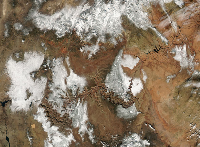
MODIS true color image (bands 1, 4, 3) of the Western United States, 23 November 2004.
Snow across the burnt-orange rock of the Colorado Plateau makes the rugged topography of the Grand Canyon of the Colorado River leap out from the center of this image captured by the Moderate Resolution Imaging Spectroradiometer (MODIS) sensor on NASA's Aqua satellite on November 23, 2004.
Although the event is not visible at the spatial resolution (level of detail) provided by MODIS, a major, planned flood of the Grand Canyon was occurring at the time this image was captured. Since humans constructed dams across the Colorado, the seasonal cycle that brought roaring, sediment-laden floods through the canyon each spring with the snowmelt have stopped. The sandbars and river banks that provided habitat for the canyon's plants and animals have steadily eroded, and in the process, several species have become extinct or endangered. In 1996, scientists and engineers let loose a planned flood from the Glen Canyon Dam to try to begin rebuilding some of this habitat. A second major flood of the canyon got underway on Sunday, November 21, and lasted until Thursday, November 25.
Text courtesy of NASA's Earth
Observatory.
Image courtesy of NASA's MODIS Land Rapid Response Team.