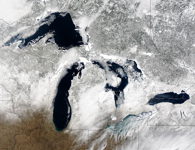
Terra MODIS true color image of the Great Lakes, 26 February 2004.
Snow paints the land of the northern central United States and southern central Canada in shades of gray and white and brings the texture of the landscape into view, while bright white ice clogs the shores and large portions of the surfaces of the Great Lakes. The deep blue-black water of the Lakes stands out in stark contrast against the ice, which floats in large chunks along the shorelines of Superior (top), Michigan (center left), and Huron (center right). Lake Ontario, on the right side of the image, also features clear deep waters, though almost no ice floats on its surface. By far, Erie is the most ice-covered of the five, and its waters swirl with clouds of blue-green.
Erie is the shallowest of the lakes (64m deep), and the only one whose floor is above sea level. Because it is usually icebound during the winter, it's usually closed to navigation from mid-December to the end of March, despite it being part of the Great Lakes - St. Lawrence Seaway System. For more information about Lake Erie and the rest of the Great Lakes, please visit Encyclopedia.com. This true-color Terra MODIS image was acquired on February 26, 2004.
Text and image courtesy of NASA's MODIS Land Rapid Response Team.